Area Overview for LS27 9WZ
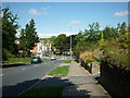
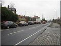
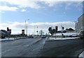
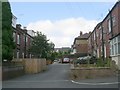
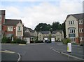
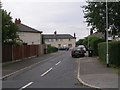
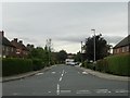
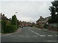
Photos of LS27 9WZ


Area Information
Living in LS27 9WZ offers a quiet, residential experience in a small cluster of homes with a population of 1,599. This area is defined by its compact size and the presence of family-oriented housing, reflecting a community that prioritises stability. The median age of 47 suggests a mature demographic, with most residents falling between 30 and 64 years old. Daily life here is likely characterised by a slower pace, with easy access to nearby amenities and transport links. The absence of major environmental constraints or high-risk factors means residents can enjoy a low-stress environment. For those seeking a place to settle long-term, LS27 9WZ provides a blend of practicality and accessibility, with proximity to retail, rail services, and a primary school. The area’s small scale fosters a sense of familiarity, though it remains connected to larger networks through its transport infrastructure. Whether you’re commuting or looking for a base near local services, LS27 9WZ offers a straightforward, no-frills lifestyle.
- Area Type
- Postcode
- Area Size
- Not available
- Population
- 1599
- Population Density
- 5534 people/km²
The property market in LS27 9WZ is heavily skewed towards owner-occupation, with 84% of homes owned by their residents. This high rate of home ownership suggests a stable, long-term demographic with little reliance on rental properties. The accommodation type is exclusively houses, which is unusual for areas with higher apartment or flat density. This means the housing stock is likely characterised by single-family homes, which may appeal to families or those seeking more space. Given the small size of the area, the number of available properties is limited, making it a niche market for buyers. The focus on owner-occupied housing also implies that the area is not a hotspot for short-term rentals or speculative investment. For those considering purchase, the scarcity of properties combined with the dominance of owner-occupation could indicate a competitive market where demand is steady but not overwhelming.
House Prices in LS27 9WZ
No properties found in this postcode.
Energy Efficiency in LS27 9WZ
Residents of LS27 9WZ have access to a range of nearby amenities, including five retail outlets such as Morrisons Tingley, Co-op Gildersome, and Tesco Morley. These shops provide essential grocery and retail services, reducing the need for long trips to larger centres. The area’s rail stations—Morley, Cottingley, and Batley—offer convenient travel options for commuting or visiting nearby attractions. While the data does not mention parks or leisure facilities, the presence of retail and transport hubs suggests a functional lifestyle focused on practicality. The limited number of amenities means residents may need to travel slightly further for specialised services, but the proximity to major retail and rail networks ensures daily needs are met without significant inconvenience.
Amenities
Schools
The nearest school to LS27 9WZ is St Peter’s CofE Infant School, a primary institution serving young children. No secondary schools or other educational institutions are listed in the data, so families with older children may need to look further afield. The presence of a primary school suggests that the area is suitable for raising young children, though parents of teenagers may find limited local options. The single school listed indicates a modest educational infrastructure, which could mean that students attend schools in nearby towns such as Morley or Batley. For families prioritising proximity to schools, St Peter’s CofE Infant School provides a foundation, but additional research would be needed to assess the quality of education and transport links to other schools.
| Rank | School | Type | Entry gender | Ages |
|---|
Explore more schools in this area
Go to Schools tabDemographics
The community in LS27 9WZ is predominantly composed of adults aged 30 to 64, with a median age of 47. This suggests a population that is largely in their prime working years, with a strong presence of families and established households. Home ownership is high, at 84%, indicating a stable housing market where most residents own their properties. The accommodation type is primarily houses, which aligns with the area’s residential character and suggests a focus on family homes rather than apartments or flats. The predominant ethnic group is White, though no specific data on diversity or deprivation levels is provided. The age profile and ownership figures imply a community that values long-term residency and property investment. With no mention of social deprivation metrics, the area appears to support a quality of life that meets basic needs, though further data would be needed to assess broader socioeconomic factors.
Household Size
Accommodation Type
Tenure
Ethnic Group
Religion
Household Composition
Age
Household Deprivation
NS-SEC
Explore more demographic insights in this area
Go to Demographics tabPlanning
Planning Constraints
- Flood RiskPremium
- Ramsar Wetland SitesPremium
- Area of Outstanding Natural BeautyPremium
- Protected Nature ReservePremium
- Protected WoodlandPremium