Area Overview for LS27 9RA
Photos of LS27 9RA
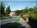
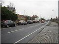
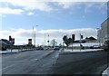
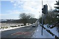
100 photos from this area
Area Information
Key information about the LS27 9RA including its size, population, and administrative classification.
- Area Type
- Postcode
- Area Size
- 2.3 hectares
- Population
- 1602
- Population Density
- 3242 people/km²
House Prices in LS27 9RA
60
Properties
£130,800
Average Sold Price
£37,500
Lowest Price
£285,000
Highest Price
Showing 60 properties
| Address | Type | Beds | Baths | Last Sale Price | Last Sale Date | |
|---|---|---|---|---|---|---|
| 84 Ingle Avenue, Morley, LS27 9RA | Detached | 3 | 1 | £182,750 | Apr 2025 | |
| 117 Ingle Avenue, Morley, LS27 9RA | Flat | - | - | £95,000 | Feb 2025 | |
| 55 Ingle Avenue, Morley, LS27 9RA | Semi-detached | 4 | 2 | £285,000 | Jun 2023 | |
| 66 Ingle Avenue, Morley, LS27 9RA | house | 3 | 1 | £186,000 | Feb 2022 | |
| 107 Ingle Avenue, Morley, LS27 9RA | Flat | - | - | £88,000 | Mar 2016 | |
| 101 Ingle Avenue, Morley, LS27 9RA | Flat | - | - | £74,950 | Nov 2014 | |
| 72 Ingle Avenue, Morley, LS27 9RA | house | 3 | - | £103,000 | Oct 2010 | |
| 59 Ingle Avenue, Morley, LS27 9RA | Semi-detached | - | - | £125,000 | Jun 2008 | |
| 64 Ingle Avenue, Morley, LS27 9RA | Semi-detached | - | - | £37,500 | Aug 2001 | |
| 71 Ingle Avenue, Morley, LS27 9RA | Semi-detached | 3 | 2 | - | - |
Page 1 of 6
Energy Efficiency in LS27 9RA
Amenities
Schools
| Rank | School | Type | Entry gender | Ages |
|---|
Explore more schools in this area
Go to Schools tabDemographics
Household Size
Family (3-5 people)
most common
Accommodation Type
Houses
most common
Tenure
51
majority
Ethnic Group
White
most common
Religion
N/A
most common
Household Composition
N/A
most common
Age
47
median
Adults (30-64 years)
most common
Household Deprivation
N/A
with no deprivation
NS-SEC
26
in Lower managerial occupations
Explore more demographic insights in this area
Go to Demographics tabPlanning
Planning Constraints
- Flood RiskPremium
- Ramsar Wetland SitesPremium
- Area of Outstanding Natural BeautyPremium
- Protected Nature ReservePremium
- Protected WoodlandPremium