Area Overview for LS27 9QQ
Photos of LS27 9QQ
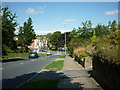
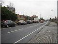
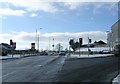
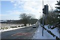

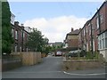
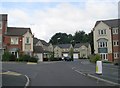
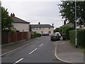
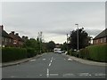
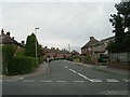
100 photos from this area
Area Information
Key information about the LS27 9QQ including its size, population, and administrative classification.
- Area Type
- Postcode
- Area Size
- 7373 m²
- Population
- 1551
- Population Density
- 7393 people/km²
House Prices in LS27 9QQ
34
Properties
£97,750
Average Sold Price
£37,500
Lowest Price
£158,000
Highest Price
Showing 34 properties
| Address | Type | Beds | Baths | Last Sale Price | Last Sale Date | |
|---|---|---|---|---|---|---|
| 71 Nepshaw Lane, Morley, LS27 9QQ | Flat | - | - | £92,000 | Sep 2021 | |
| 65 Nepshaw Lane, Morley, LS27 9QQ | Maisonette | - | - | £37,500 | Sep 2019 | |
| 35 Nepshaw Lane, Morley, LS27 9QQ | Terraced | 3 | 1 | £158,000 | Feb 2019 | |
| 33 Nepshaw Lane, Morley, LS27 9QQ | house | - | - | £120,000 | Jan 2009 | |
| 25 Nepshaw Lane, Morley, LS27 9QQ | Terraced | - | - | £124,000 | Apr 2006 | |
| 27 Nepshaw Lane, Morley, LS27 9QQ | Terraced | - | - | £135,000 | Nov 2004 | |
| 29 Nepshaw Lane, Morley, LS27 9QQ | house | 3 | 1 | £71,000 | Nov 2002 | |
| 19 Nepshaw Lane, Morley, LS27 9QQ | house | - | - | £44,500 | Dec 1999 | |
| 15 Nepshaw Lane, Morley, LS27 9QQ | Semi-detached | 3 | 1 | - | - | |
| 17 Nepshaw Lane, Morley, LS27 9QQ | Terraced | - | - | - | - |
Page 1 of 4
Energy Efficiency in LS27 9QQ
Amenities
Schools
| Rank | School | Type | Entry gender | Ages |
|---|
Explore more schools in this area
Go to Schools tabDemographics
Household Size
Two person
most common
Accommodation Type
Houses
most common
Tenure
72
majority
Ethnic Group
White
most common
Religion
N/A
most common
Household Composition
N/A
most common
Age
47
median
Adults (30-64 years)
most common
Household Deprivation
N/A
with no deprivation
NS-SEC
33
in Lower managerial occupations
Explore more demographic insights in this area
Go to Demographics tabPlanning
Planning Constraints
- Flood RiskPremium
- Ramsar Wetland SitesPremium
- Area of Outstanding Natural BeautyPremium
- Protected Nature ReservePremium
- Protected WoodlandPremium