Area Overview for LS27 8SF
Photos of LS27 8SF
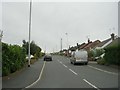
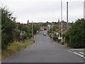
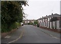
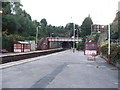

72 photos from this area
Area Information
Key information about the LS27 8SF including its size, population, and administrative classification.
- Area Type
- Postcode
- Area Size
- 1.7 hectares
- Population
- 2016
- Population Density
- 1158 people/km²
House Prices in LS27 8SF
40
Properties
£198,253
Average Sold Price
£38,500
Lowest Price
£380,000
Highest Price
Showing 40 properties
| Address | Type | Beds | Baths | Last Sale Price | Last Sale Date | |
|---|---|---|---|---|---|---|
| 68 Albert Drive, Morley, LS27 8SF | Semi-detached | 3 | 2 | £243,000 | May 2024 | |
| 62 Albert Drive, Morley, LS27 8SF | house | - | - | £324,950 | Dec 2022 | |
| 70 Albert Drive, Morley, LS27 8SF | Semi-detached | 3 | 2 | £255,000 | Dec 2022 | |
| 78 Albert Drive, Morley, LS27 8SF | house | - | - | £294,950 | Sep 2022 | |
| 80 Albert Drive, Morley, LS27 8SF | Detached | 2 | 1 | £227,950 | Aug 2022 | |
| 82 Albert Drive, Morley, LS27 8SF | house | - | - | £227,950 | Aug 2022 | |
| 64 Albert Drive, Morley, LS27 8SF | Detached | 5 | 2 | £380,000 | Jul 2022 | |
| 76 Albert Drive, Morley, LS27 8SF | house | - | - | £244,950 | Sep 2020 | |
| 74 Albert Drive, Morley, LS27 8SF | house | - | - | £202,950 | Sep 2020 | |
| 72 Albert Drive, Morley, LS27 8SF | house | - | - | £197,950 | Sep 2020 |
Page 1 of 4
Energy Efficiency in LS27 8SF
Amenities
Schools
| Rank | School | Type | Entry gender | Ages |
|---|
Explore more schools in this area
Go to Schools tabDemographics
Household Size
Two person
most common
Accommodation Type
Houses
most common
Tenure
63
majority
Ethnic Group
White
most common
Religion
N/A
most common
Household Composition
N/A
most common
Age
47
median
Adults (30-64 years)
most common
Household Deprivation
N/A
with no deprivation
NS-SEC
32
in Lower managerial occupations
Explore more demographic insights in this area
Go to Demographics tabPlanning
Planning Constraints
- Flood RiskPremium
- Ramsar Wetland SitesPremium
- Area of Outstanding Natural BeautyPremium
- Protected Nature ReservePremium
- Protected WoodlandPremium