Area Overview for LS27 7TZ
Photos of LS27 7TZ
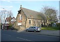
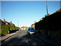
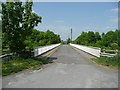

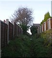
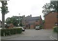
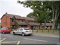
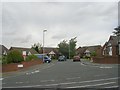
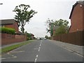
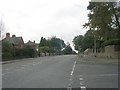
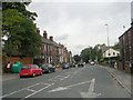
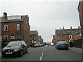
93 photos from this area
Area Information
Key information about the LS27 7TZ including its size, population, and administrative classification.
- Area Type
- Postcode
- Area Size
- 1.0 hectares
- Population
- 1599
- Population Density
- 5534 people/km²
House Prices in LS27 7TZ
27
Properties
£174,078
Average Sold Price
£62,950
Lowest Price
£319,995
Highest Price
Showing 27 properties
| Address | Type | Beds | Baths | Last Sale Price | Last Sale Date | |
|---|---|---|---|---|---|---|
| 28 Ibbetson Drive, Churwell, Morley, LS27 7TZ | house | 3 | 1 | £282,000 | Aug 2025 | |
| 11 Ibbetson Drive, Churwell, Morley, LS27 7TZ | Semi-detached | 3 | 1 | £260,000 | Dec 2024 | |
| 22 Ibbetson Drive, Churwell, Morley, LS27 7TZ | Semi-detached | 4 | 2 | £319,995 | Dec 2024 | |
| 24 Ibbetson Drive, Churwell, Morley, LS27 7TZ | Semi-detached | 3 | 1 | £275,000 | Jun 2023 | |
| 32 Ibbetson Drive, Churwell, Morley, LS27 7TZ | house | - | - | £235,000 | Sep 2021 | |
| 1 Ibbetson Drive, Churwell, Morley, LS27 7TZ | Detached | 4 | 3 | £290,000 | Jun 2021 | |
| 15 Ibbetson Drive, Churwell, Morley, LS27 7TZ | house | - | - | £205,000 | Mar 2021 | |
| 5 Ibbetson Drive, Churwell, Morley, LS27 7TZ | Bungalow | 2 | 1 | £235,000 | Jun 2018 | |
| 16 Ibbetson Drive, Churwell, Morley, LS27 7TZ | Semi-detached | 2 | 1 | £136,500 | Aug 2014 | |
| 18 Ibbetson Drive, Churwell, Morley, LS27 7TZ | house | 3 | - | £155,000 | Feb 2013 |
Page 1 of 3
Energy Efficiency in LS27 7TZ
Amenities
Schools
| Rank | School | Type | Entry gender | Ages |
|---|
Explore more schools in this area
Go to Schools tabDemographics
Household Size
Family (3-5 people)
most common
Accommodation Type
Houses
most common
Tenure
84
majority
Ethnic Group
White
most common
Religion
N/A
most common
Household Composition
N/A
most common
Age
47
median
Adults (30-64 years)
most common
Household Deprivation
N/A
with no deprivation
NS-SEC
44
in Lower managerial occupations
Explore more demographic insights in this area
Go to Demographics tabPlanning
Planning Constraints
- Flood RiskPremium
- Ramsar Wetland SitesPremium
- Area of Outstanding Natural BeautyPremium
- Protected Nature ReservePremium
- Protected WoodlandPremium