Area Overview for LS27 7LD
Photos of LS27 7LD
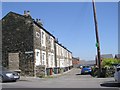
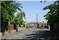
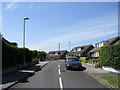
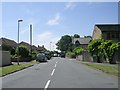
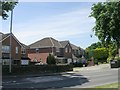
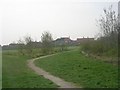


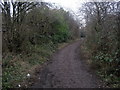
100 photos from this area
Area Information
Key information about the LS27 7LD including its size, population, and administrative classification.
- Area Type
- Postcode
- Area Size
- 8187 m²
- Population
- 1370
- Population Density
- 545 people/km²
House Prices in LS27 7LD
18
Properties
£254,833
Average Sold Price
£79,000
Lowest Price
£424,995
Highest Price
Showing 18 properties
| Address | Type | Beds | Baths | Last Sale Price | Last Sale Date | |
|---|---|---|---|---|---|---|
| 26 Turton Green, Gildersome, Morley, LS27 7LD | house | 4 | 2 | £424,995 | Aug 2025 | |
| 20 Turton Green, Gildersome, Morley, LS27 7LD | Detached | 4 | 1 | £375,000 | Mar 2025 | |
| 16 Turton Green, Gildersome, Morley, LS27 7LD | Detached | 4 | 1 | £350,000 | Mar 2025 | |
| 24 Turton Green, Gildersome, Morley, LS27 7LD | Detached | 4 | 1 | £257,500 | Jun 2017 | |
| 8 Turton Green, Gildersome, Morley, LS27 7LD | Flat | 1 | 1 | £192,000 | Oct 2010 | |
| 30 Turton Green, Gildersome, Morley, LS27 7LD | Detached | 4 | 1 | £235,000 | Dec 2006 | |
| 2 Turton Green, Gildersome, Morley, LS27 7LD | Detached | - | - | £197,000 | May 2005 | |
| 6 Turton Green, Gildersome, Morley, LS27 7LD | Detached | - | - | £183,000 | May 2004 | |
| 10 Turton Green, Gildersome, Morley, LS27 7LD | Detached | - | - | £79,000 | Jul 1997 | |
| The End Wing, Turton Hall, Turton Green, Gildersome, Morley, LS27 7LD | Detached | 4 | 2 | - | - |
Page 1 of 2
Energy Efficiency in LS27 7LD
Amenities
Schools
| Rank | School | Type | Entry gender | Ages |
|---|
Explore more schools in this area
Go to Schools tabDemographics
Household Size
Two person
most common
Accommodation Type
Houses
most common
Tenure
86
majority
Ethnic Group
White
most common
Religion
N/A
most common
Household Composition
N/A
most common
Age
47
median
Adults (30-64 years)
most common
Household Deprivation
N/A
with no deprivation
NS-SEC
38
in Lower managerial occupations
Explore more demographic insights in this area
Go to Demographics tabPlanning
Planning Constraints
- Flood RiskPremium
- Ramsar Wetland SitesPremium
- Area of Outstanding Natural BeautyPremium
- Protected Nature ReservePremium
- Protected WoodlandPremium