Area Overview for LS27 0LR
Photos of LS27 0LR
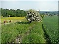


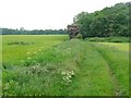
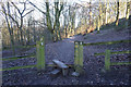
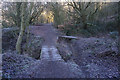


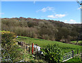

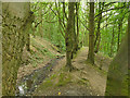
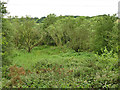
44 photos from this area
Area Information
Key information about the LS27 0LR including its size, population, and administrative classification.
- Area Type
- Postcode
- Area Size
- 48.3 hectares
- Population
- 1367
- Population Density
- 661 people/km²
House Prices in LS27 0LR
28
Properties
£115,105
Average Sold Price
£29,000
Lowest Price
£335,000
Highest Price
Showing 28 properties
| Address | Type | Beds | Baths | Last Sale Price | Last Sale Date | |
|---|---|---|---|---|---|---|
| 59 Howden Clough Road, Morley, LS27 0LR | Terraced | 2 | 1 | £119,000 | May 2025 | |
| 7, Providence Works, Howden Clough Road, Morley, LS27 0LR | Flat | - | - | £99,000 | Oct 2024 | |
| 10, Providence Works, Howden Clough Road, Morley, LS27 0LR | Flat | - | - | £126,000 | Nov 2023 | |
| 14, Providence Works, Howden Clough Road, Morley, LS27 0LR | Flat | - | - | £126,000 | Sep 2023 | |
| 61 Howden Clough Road, Morley, LS27 0LR | house | 2 | 1 | £110,000 | Oct 2022 | |
| Shoulder Oaks, 51 Howden Clough Road, Morley, LS27 0LR | house | - | - | £335,000 | Sep 2022 | |
| 12, Providence Works, Howden Clough Road, Morley, LS27 0LR | Flat | 2 | 2 | £107,000 | Aug 2021 | |
| 55 Howden Clough Road, Morley, LS27 0LR | house | 2 | 1 | £75,000 | Oct 2020 | |
| 11, Providence Works, Howden Clough Road, Morley, LS27 0LR | Flat | - | - | £95,000 | Nov 2018 | |
| 16, Providence Works, Howden Clough Road, Morley, LS27 0LR | Flat | 2 | 1 | £98,000 | Jul 2018 |
Page 1 of 3
Energy Efficiency in LS27 0LR
Amenities
Schools
| Rank | School | Type | Entry gender | Ages |
|---|
Explore more schools in this area
Go to Schools tabDemographics
Household Size
Two person
most common
Accommodation Type
Houses
most common
Tenure
76
majority
Ethnic Group
White
most common
Religion
N/A
most common
Household Composition
N/A
most common
Age
47
median
Adults (30-64 years)
most common
Household Deprivation
N/A
with no deprivation
NS-SEC
36
in Lower managerial occupations
Explore more demographic insights in this area
Go to Demographics tabPlanning
Planning Constraints
- Flood RiskPremium
- Ramsar Wetland SitesPremium
- Area of Outstanding Natural BeautyPremium
- Protected Nature ReservePremium
- Protected WoodlandPremium