Area Overview for LS26 9LD
Photos of LS26 9LD
![Birds at St Aidan's [1] in LS26 9LD](https://images.propbar.co.uk/images/geograph/45/80/4580900_120.jpg)
![Drainage outlet from St Aidan's to the River Aire [1] in LS26 9LD](https://images.propbar.co.uk/images/geograph/45/80/4580929_120.jpg)
![Interconnected lakes, St Aidan's [2] in LS26 9LD](https://images.propbar.co.uk/images/geograph/45/80/4580942_120.jpg)
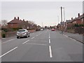
100 photos from this area
Area Information
Key information about the LS26 9LD including its size, population, and administrative classification.
- Area Type
- Postcode
- Area Size
- 2.7 hectares
- Population
- 2202
- Population Density
- 1232 people/km²
House Prices in LS26 9LD
45
Properties
£226,202
Average Sold Price
£82,500
Lowest Price
£410,000
Highest Price
Showing 45 properties
| Address | Type | Beds | Baths | Last Sale Price | Last Sale Date | |
|---|---|---|---|---|---|---|
| 6 Longbow Avenue, Methley, Leeds, LS26 9LD | Detached | 4 | 2 | £410,000 | Aug 2025 | |
| 38 Longbow Avenue, Methley, Leeds, LS26 9LD | Detached | 4 | 2 | £390,000 | Jan 2025 | |
| 46 Longbow Avenue, Methley, Leeds, LS26 9LD | Detached | 3 | 2 | £315,000 | Nov 2024 | |
| 18 Longbow Avenue, Methley, Leeds, LS26 9LD | Detached | 4 | 2 | £410,000 | Aug 2023 | |
| 28 Longbow Avenue, Methley, Leeds, LS26 9LD | Detached | 4 | 2 | £346,500 | Jun 2023 | |
| 33 Longbow Avenue, Methley, Leeds, LS26 9LD | Detached | 4 | - | £330,000 | Oct 2022 | |
| 44 Longbow Avenue, Methley, Leeds, LS26 9LD | house | - | - | £340,000 | Sep 2021 | |
| 40 Longbow Avenue, Methley, Leeds, LS26 9LD | Detached | 3 | 3 | £260,000 | Aug 2021 | |
| 29 Longbow Avenue, Methley, Leeds, LS26 9LD | house | - | - | £360,000 | Jul 2021 | |
| 20 Longbow Avenue, Methley, Leeds, LS26 9LD | house | - | - | £258,000 | May 2021 |
Page 1 of 5
Energy Efficiency in LS26 9LD
Amenities
Schools
| Rank | School | Type | Entry gender | Ages |
|---|
Explore more schools in this area
Go to Schools tabDemographics
Household Size
Family (3-5 people)
most common
Accommodation Type
Houses
most common
Tenure
80
majority
Ethnic Group
White
most common
Religion
N/A
most common
Household Composition
N/A
most common
Age
47
median
Adults (30-64 years)
most common
Household Deprivation
N/A
with no deprivation
NS-SEC
44
in Lower managerial occupations
Explore more demographic insights in this area
Go to Demographics tabPlanning
Planning Constraints
- Flood RiskPremium
- Ramsar Wetland SitesPremium
- Area of Outstanding Natural BeautyPremium
- Protected Nature ReservePremium
- Protected WoodlandPremium