Area Overview for LS26 9BX
Photos of LS26 9BX
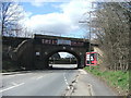
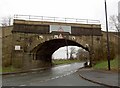
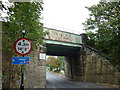
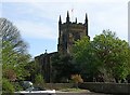
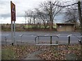
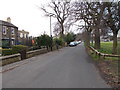
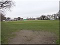
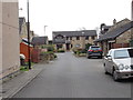
85 photos from this area
Area Information
Key information about the LS26 9BX including its size, population, and administrative classification.
- Area Type
- Postcode
- Area Size
- 9142 m²
- Population
- 1198
- Population Density
- 279 people/km²
House Prices in LS26 9BX
17
Properties
£146,188
Average Sold Price
£40,000
Lowest Price
£223,300
Highest Price
Showing 17 properties
| Address | Type | Beds | Baths | Last Sale Price | Last Sale Date | |
|---|---|---|---|---|---|---|
| 13 Watergate, Methley, Leeds, LS26 9BX | Semi-detached | 3 | 1 | £223,300 | Oct 2023 | |
| 19 Watergate, Methley, Leeds, LS26 9BX | Semi-detached | 3 | 1 | £210,000 | Sep 2021 | |
| 33 Watergate, Methley, Leeds, LS26 9BX | Semi-detached | 3 | 1 | £220,000 | Dec 2020 | |
| 15 Watergate, Methley, Leeds, LS26 9BX | Semi-detached | - | - | £135,000 | Dec 2017 | |
| 29 Watergate, Methley, Leeds, LS26 9BX | Semi-detached | 3 | - | £119,500 | Apr 2014 | |
| 27 Watergate, Methley, Leeds, LS26 9BX | house | 3 | - | £133,000 | Jul 2013 | |
| 23 Watergate, Methley, Leeds, LS26 9BX | house | - | - | £139,000 | Aug 2011 | |
| 11 Watergate, Methley, Leeds, LS26 9BX | house | 3 | - | £133,000 | Jun 2011 | |
| 35 Watergate, Methley, Leeds, LS26 9BX | house | - | - | £139,000 | May 2008 | |
| 7 Watergate, Methley, Leeds, LS26 9BX | house | - | - | £147,500 | May 2007 |
Page 1 of 2
Energy Efficiency in LS26 9BX
Amenities
Schools
| Rank | School | Type | Entry gender | Ages |
|---|
Explore more schools in this area
Go to Schools tabDemographics
Household Size
Family (3-5 people)
most common
Accommodation Type
Houses
most common
Tenure
75
majority
Ethnic Group
White
most common
Religion
N/A
most common
Household Composition
N/A
most common
Age
47
median
Adults (30-64 years)
most common
Household Deprivation
N/A
with no deprivation
NS-SEC
38
in Lower managerial occupations
Explore more demographic insights in this area
Go to Demographics tabPlanning
Planning Constraints
- Flood RiskPremium
- Ramsar Wetland SitesPremium
- Area of Outstanding Natural BeautyPremium
- Protected Nature ReservePremium
- Protected WoodlandPremium