Area Overview for LS26 8SD
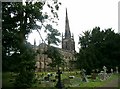
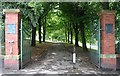
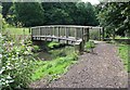
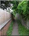
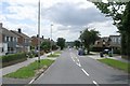
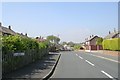
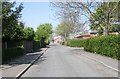
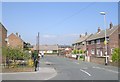
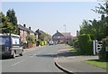
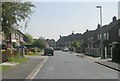
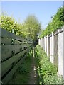
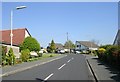
Photos of LS26 8SD
Area Information
LS26 8SD is a compact residential postcode area in England, covering 4,142 square metres and home to 1,808 residents. Its high population density of 436,470 people per square kilometre reflects a tightly knit community, where daily life is shaped by proximity to essential services. The area is characterised by a predominance of owner-occupied homes, with 85% of properties in private hands. This suggests a stable, long-term resident base, likely centred around family households. The small footprint of LS26 8SD means it is a self-contained cluster, with residents often walking or cycling to nearby amenities. The area’s appeal lies in its balance of residential tranquillity and practical connectivity, with schools, shops, and transport links within easy reach. While it lacks expansive green spaces, its density supports a vibrant local economy and social fabric. For those seeking a community-oriented lifestyle with minimal commute distances, LS26 8SD offers a focused, manageable environment. Its proximity to Woodlesford and surrounding towns adds to its accessibility for broader regional opportunities.
- Area Type
- Postcode
- Area Size
- 4142 m²
- Population
- 1808
- Population Density
- 3678 people/km²
LS26 8SD is a predominantly owner-occupied area, with 85% of properties in private hands. This high rate of home ownership suggests a stable market with residents likely to hold properties long-term. The accommodation type is exclusively houses, indicating a focus on family homes rather than apartments or flats. This composition is typical of smaller, rural or semi-rural postcode areas where detached or semi-detached housing is the norm. The limited area size of 4,142 square metres means the housing stock is constrained, which could make the local property market competitive for buyers. For those seeking homes in LS26 8SD, the emphasis on owner-occupation means rental availability is likely limited, and properties may be priced with long-term residency in mind. Buyers should consider the surrounding areas for additional options, as the immediate vicinity may have fewer properties. The presence of nearby rail stations, such as Woodlesford and Cross Gates, adds to the area’s appeal for commuters or those seeking access to larger urban centres.
House Prices in LS26 8SD
Showing 14 properties
| Address | Type | Beds | Baths | Last Sale Price | Last Sale Date | |
|---|---|---|---|---|---|---|
| 132 Holmsley Lane, Woodlesford, Leeds, LS26 8SD | Semi-detached | - | - | £59,500 | Oct 2001 | |
| 3, Holmsley Green, Holmsley Lane, Woodlesford, Leeds, LS26 8SD | Flat | - | - | - | - | |
| 10, Holmsley Green, Holmsley Lane, Woodlesford, Leeds, LS26 8SD | Flat | - | - | - | - | |
| 11, Holmsley Green, Holmsley Lane, Woodlesford, Leeds, LS26 8SD | Flat | - | - | - | - | |
| 6, Holmsley Green, Holmsley Lane, Woodlesford, Leeds, LS26 8SD | Flat | - | - | - | - | |
| Holmsley Green, Holmsley Lane, Woodlesford, Leeds, LS26 8SD | commercial | - | - | - | - | |
| 1, Holmsley Green, Holmsley Lane, Woodlesford, Leeds, LS26 8SD | Flat | - | - | - | - | |
| 4, Holmsley Green, Holmsley Lane, Woodlesford, Leeds, LS26 8SD | Flat | - | - | - | - | |
| 2, Holmsley Green, Holmsley Lane, Woodlesford, Leeds, LS26 8SD | Flat | - | - | - | - | |
| 7, Holmsley Green, Holmsley Lane, Woodlesford, Leeds, LS26 8SD | Flat | - | - | - | - |
Energy Efficiency in LS26 8SD
The lifestyle in LS26 8SD is shaped by its proximity to essential amenities. Residents can access a range of retail options, including Tesco Rothwell Leeds, Lidl Woodlesford, and Co-op Woodlesford, which provide everyday shopping needs. The nearby rail stations—Woodlesford, Cross Gates, and Outwood—offer convenient travel links to surrounding towns and cities, supporting both commuting and leisure activities. While the area does not feature expansive parks or recreational spaces, its compact size ensures that services are within walking or cycling distance. The presence of Langdale Primary School and Eastfield School also contributes to a family-friendly environment. The high population density means the community is closely knit, with a focus on local interactions. For those who enjoy a mix of practicality and accessibility, LS26 8SD offers a lifestyle where daily necessities are readily available, though larger-scale leisure opportunities may require venturing slightly beyond the immediate area.
Amenities
Schools
Residents of LS26 8SD have access to two notable educational institutions. Langdale Primary School and Nursery provides early years and primary education, catering to younger families in the area. Eastfield School, a special school, offers tailored support for students with specific educational needs. The combination of a primary school and a special school suggests a diverse educational landscape, accommodating both general and specialist requirements. For families, this mix ensures a range of options depending on children’s needs. However, the absence of secondary schools in the immediate area means residents may need to travel to nearby towns for further education. The presence of both school types reflects a community that values inclusivity and accessibility in education, though the limited number of schools may necessitate careful planning for families with multiple children or those requiring specialist provision.
| Rank | School | Type | Entry gender | Ages |
|---|
Explore more schools in this area
Go to Schools tabDemographics
The population of LS26 8SD is predominantly adults aged 30–64, with a median age of 47. This suggests a mature, established community with a strong presence of families and professionals. Home ownership is exceptionally high at 85%, indicating a long-term commitment to the area. The accommodation type is largely houses, reflecting a preference for standalone properties over flats. The predominant ethnic group is White, with no specific data on other demographics. The high population density of 436,470 people per square kilometre implies a closely packed residential layout, which may influence social dynamics and local infrastructure demands. For residents, this density ensures proximity to services but could also mean limited space for expansion. The age profile suggests a stable, low-turnover community, with potential for strong local networks and long-term property value retention. However, the lack of diversity data means the area’s cultural and social composition remains less defined in the provided information.
Household Size
Accommodation Type
Tenure
Ethnic Group
Religion
Household Composition
Age
Household Deprivation
NS-SEC
Explore more demographic insights in this area
Go to Demographics tabPlanning
Planning Constraints
- Flood RiskPremium
- Ramsar Wetland SitesPremium
- Area of Outstanding Natural BeautyPremium
- Protected Nature ReservePremium
- Protected WoodlandPremium