Area Overview for LS26 8QH
Photos of LS26 8QH
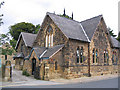
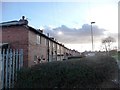
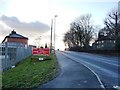
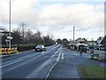
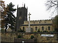
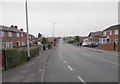
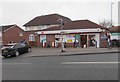
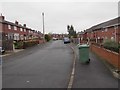
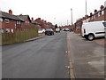
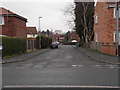
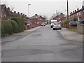
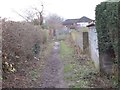
100 photos from this area
Area Information
Key information about the LS26 8QH including its size, population, and administrative classification.
- Area Type
- Postcode
- Area Size
- 1.7 hectares
- Population
- 1558
- Population Density
- 91715 people/km²
House Prices in LS26 8QH
49
Properties
£178,686
Average Sold Price
£55,000
Lowest Price
£355,000
Highest Price
Showing 49 properties
| Address | Type | Beds | Baths | Last Sale Price | Last Sale Date | |
|---|---|---|---|---|---|---|
| 21 Church Avenue, Swillington, Leeds, LS26 8QH | Semi-detached | 3 | 1 | £280,000 | May 2025 | |
| 52 Church Avenue, Swillington, Leeds, LS26 8QH | Detached | 3 | 1 | £300,000 | Dec 2024 | |
| 37 Church Avenue, Swillington, Leeds, LS26 8QH | Detached | 4 | 1 | £335,000 | Oct 2024 | |
| 48 Church Avenue, Swillington, Leeds, LS26 8QH | Detached | 3 | 2 | £295,000 | Oct 2024 | |
| 9 Church Avenue, Swillington, Leeds, LS26 8QH | Semi-detached | 3 | 1 | £227,000 | May 2024 | |
| 7 Church Avenue, Swillington, Leeds, LS26 8QH | house | - | - | £215,000 | Feb 2023 | |
| 19 Church Avenue, Swillington, Leeds, LS26 8QH | Detached | 3 | 1 | £355,000 | Jun 2022 | |
| 38 Church Avenue, Swillington, Leeds, LS26 8QH | Retail | 3 | 1 | £218,000 | May 2022 | |
| 4 Church Avenue, Swillington, Leeds, LS26 8QH | house | - | - | £232,200 | Nov 2021 | |
| 40 Church Avenue, Swillington, Leeds, LS26 8QH | Semi-detached | 3 | 1 | £200,000 | Mar 2021 |
Page 1 of 5
Energy Efficiency in LS26 8QH
Amenities
Schools
| Rank | School | Type | Entry gender | Ages |
|---|
Explore more schools in this area
Go to Schools tabDemographics
Household Size
Two person
most common
Accommodation Type
Houses
most common
Tenure
70
majority
Ethnic Group
White
most common
Religion
N/A
most common
Household Composition
N/A
most common
Age
47
median
Adults (30-64 years)
most common
Household Deprivation
N/A
with no deprivation
NS-SEC
26
in Lower managerial occupations
Explore more demographic insights in this area
Go to Demographics tabPlanning
Planning Constraints
- Flood RiskPremium
- Ramsar Wetland SitesPremium
- Area of Outstanding Natural BeautyPremium
- Protected Nature ReservePremium
- Protected WoodlandPremium