Area Overview for LS26 8BS
Photos of LS26 8BS


Area Information
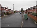
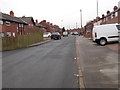
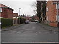
LS26 8BS is a compact residential postcode in England, covering just 7.1 hectares and home to 1,365 people. Its high population density of 19,321 people per square kilometre reflects a tightly knit community, where proximity to essential services and transport links is a defining feature. This area is not a sprawling suburb but a focused cluster of homes, likely centred around local amenities and infrastructure. Residents benefit from proximity to retail hubs like Tesco Swillington and Sainsburys Kippax, as well as rail access via Woodlesford and Garforth stations, which connect to broader regional networks. The area’s small size means it is likely integrated into nearby towns, offering a balance of local convenience and access to larger urban centres. Daily life here is shaped by a mature population, with a median age of 47 and a strong presence of adults aged 30–64, suggesting a community rooted in stability and routine. The absence of environmental constraints like protected woodlands or Ramsar sites means development is unencumbered, though this also implies a lack of natural landscapes within the immediate area. For buyers, this is a place where practicality and accessibility outweigh scenic or recreational amenities.
- Area Type
- Postcode
- Area Size
- 7.1 hectares
- Population
- 1365
- Population Density
- 1587 people/km²
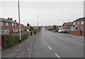
The property market in LS26 8BS is dominated by owner-occupied homes, with 65% of properties in private hands. This contrasts with rental markets, where buy-to-let or student housing might be more common. The accommodation type is exclusively houses, indicating a lack of flats or apartments, which may appeal to families or those seeking more space. Given the area’s small size and high population density, the housing stock is likely limited, with properties concentrated in a tight cluster. Buyers should expect a focus on traditional family homes rather than modern developments. The absence of planning constraints like protected woodlands or AONB designations suggests flexibility for future development, though this may also mean limited green spaces. For those seeking a quiet, residential area with easy access to transport, LS26 8BS offers a compact alternative to larger towns, though its small footprint may restrict property choice.
House Prices in LS26 8BS
No properties found in this postcode.
Energy Efficiency in LS26 8BS
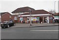
Living in LS26 8BS offers practical access to essential amenities, with five retail outlets within reach, including major supermarkets like Tesco Swillington and Sainsburys Kippax. These provide convenience for grocery shopping, reducing the need for long trips to larger towns. The area’s rail network, with stations at Woodlesford, Garforth, and East Garforth, ensures easy access to commuting routes, whether for work, education, or leisure. While there is no mention of parks or leisure facilities in the data, the proximity to rail and retail suggests a lifestyle focused on efficiency rather than recreation. The compact nature of the postcode means residents are likely within walking or short driving distance of these services, fostering a sense of self-sufficiency. For those prioritising accessibility over expansive green spaces, LS26 8BS delivers a functional, community-oriented environment.
Amenities
Schools
| Rank | School | Type | Entry gender | Ages |
|---|
Explore more schools in this area
Go to Schools tabDemographics
The population of LS26 8BS is predominantly adults aged 30–64, with a median age of 47, indicating a mature, established community. Home ownership is high, at 65%, suggesting a stable demographic with long-term residency. The area is characterised by houses rather than flats or apartments, reflecting a preference for private, family-oriented living. The predominant ethnic group is White, with no specific data on other groups provided. This homogeneity may contribute to a cohesive, low-conflict social environment. The age profile implies a mix of working professionals and families, with fewer young children or retirees compared to other areas. The absence of detailed deprivation data means it is unclear how economic pressures might affect quality of life, but the high home ownership rate and low crime risk (74/100) suggest a relatively secure, middle-income community. The area’s compact size and high density mean social interactions are likely frequent, fostering a sense of familiarity among residents.
Household Size
Accommodation Type
Tenure
Ethnic Group
Religion
Household Composition
Age
Household Deprivation
NS-SEC
Explore more demographic insights in this area
Go to Demographics tabPlanning
Planning Constraints
- Flood RiskPremium
- Ramsar Wetland SitesPremium
- Area of Outstanding Natural BeautyPremium
- Protected Nature ReservePremium
- Protected WoodlandPremium