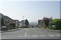
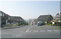
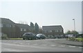
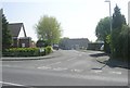
Area Overview for LS26 0XD
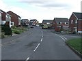
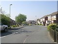
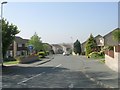
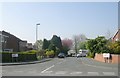
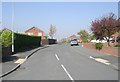
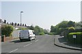
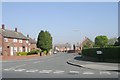
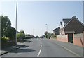
Photos of LS26 0XD
Area Information
LS26 0XD is a compact residential postcode in England, covering just 1,916 square metres and home to 2,019 residents. Its high population density of 1,053,678 people per square kilometre reflects a tightly knit community, though the area remains small enough to foster familiarity among residents. The postcode’s character is defined by its mix of mature households and stable home ownership, with a median age of 47 and most residents falling within the 30–64 age range. Daily life here is shaped by proximity to essential services and transport links, making it practical for those who value convenience without sacrificing a sense of place. While the area lacks large-scale amenities, its compact nature means residents can access shops, rail stations, and other facilities within a short distance. This blend of density and accessibility makes LS26 0XD a viable option for those seeking a residential area with strong connectivity and a community-oriented environment.
- Area Type
- Postcode
- Area Size
- 1916 m²
- Population
- 2019
- Population Density
- 2940 people/km²
The property market in LS26 0XD is dominated by owner-occupied homes, with 78% of residents owning their properties. This high rate of home ownership suggests a community of long-term residents rather than a transient rental market. The accommodation type is primarily houses, which contrasts with areas where flats or apartments predominate. This indicates a focus on family-oriented housing, potentially with larger living spaces. Given the area’s small size and high population density, the housing stock is likely limited, meaning buyers may need to look beyond LS26 0XD itself to find options. The predominance of houses also implies that the area is not heavily developed with high-rise or commercial properties, maintaining a residential character. For buyers, this means a market that prioritises stability and permanence, though the limited supply could make competition for properties fierce. The compact nature of the postcode also means that proximity to amenities is a key selling point, as residents rely on nearby services for daily needs.
House Prices in LS26 0XD
Showing 3 properties
| Address | Type | Beds | Baths | Last Sale Price | Last Sale Date | |
|---|---|---|---|---|---|---|
| 3 Home Lea Drive, Rothwell, Leeds, LS26 0XD | Detached | 4 | 2 | - | - | |
| 2 Home Lea Drive, Rothwell, Leeds, LS26 0XD | Detached | - | - | - | - | |
| 1 Home Lea Drive, Rothwell, Leeds, LS26 0XD | Bungalow | - | - | - | - |
Energy Efficiency in LS26 0XD
Living in LS26 0XD offers access to a range of practical amenities within close reach. Retail options include major stores such as Morrisons John O’Gaunts, Aldi Carlton, and Tesco Rothwell Leeds, providing convenience for grocery shopping and daily essentials. These shops cater to a variety of needs, from fresh produce to household goods, supporting a self-sufficient lifestyle. The area’s rail network, with stations like Woodlesford and Outwood, connects residents to broader regional networks, facilitating travel to nearby cities and employment centres. While the postcode itself is small, the density of services ensures that residents do not need to travel far for basic needs. The presence of multiple retail and transport hubs contributes to a lifestyle that prioritises efficiency and accessibility. This makes LS26 0XD appealing to those who value a compact, well-serviced environment without the need for extensive commuting or long-distance shopping trips.
Amenities
Schools
| Rank | School | Type | Entry gender | Ages |
|---|
Explore more schools in this area
Go to Schools tabDemographics
The community in LS26 0XD is predominantly composed of adults aged 30–64, with a median age of 47. This suggests a population skewed towards middle-aged individuals, likely including families and professionals in their prime earning years. Home ownership is high at 78%, indicating a stable, long-term resident base rather than a transient rental market. The accommodation type is primarily houses, which aligns with the area’s residential character and suggests a focus on family-friendly living. The predominant ethnic group is White, though no specific data on diversity or deprivation is provided. The high population density, while unusual for such a small area, implies a compact, efficient use of space. This density may influence local dynamics, such as shared community spaces or reliance on nearby amenities. The age profile and ownership rates suggest a community that values stability and proximity to services, which is reflected in the area’s transport and retail offerings.
Household Size
Accommodation Type
Tenure
Ethnic Group
Religion
Household Composition
Age
Household Deprivation
NS-SEC
Explore more demographic insights in this area
Go to Demographics tabPlanning
Planning Constraints
- Flood RiskPremium
- Ramsar Wetland SitesPremium
- Area of Outstanding Natural BeautyPremium
- Protected Nature ReservePremium
- Protected WoodlandPremium