Area Overview for LS25 7FH
Photos of LS25 7FH
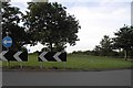
![Houses on the south side of the Selby Road [A63] in LS25 7FH](https://images.propbar.co.uk/images/geograph/37/75/3775103_120.jpg)
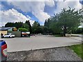
![The Selby Road [A63] in LS25 7FH](https://images.propbar.co.uk/images/geograph/37/75/3775123_120.jpg)

14 photos from this area
Area Information
Key information about the LS25 7FH including its size, population, and administrative classification.
- Area Type
- Postcode
- Area Size
- 3.8 hectares
- Population
- 1781
- Population Density
- 726 people/km²
House Prices in LS25 7FH
9
Properties
£240,400
Average Sold Price
£192,950
Lowest Price
£337,500
Highest Price
Showing 9 properties
| Address | Type | Beds | Baths | Last Sale Price | Last Sale Date | |
|---|---|---|---|---|---|---|
| 3 Roach Hill View, Kippax, Leeds, LS25 7FH | Detached | 3 | 2 | £265,000 | Jun 2025 | |
| 8 Roach Hill View, Kippax, Leeds, LS25 7FH | Retail | 4 | 2 | £337,500 | Nov 2022 | |
| 6 Roach Hill View, Kippax, Leeds, LS25 7FH | house | - | - | £292,950 | Dec 2021 | |
| 9 Roach Hill View, Kippax, Leeds, LS25 7FH | house | - | - | £204,950 | Mar 2021 | |
| 7 Roach Hill View, Kippax, Leeds, LS25 7FH | house | - | - | £192,950 | Mar 2021 | |
| 1 Roach Hill View, Kippax, Leeds, LS25 7FH | Detached | 3 | 2 | £209,950 | Jun 2019 | |
| 2 Roach Hill View, Kippax, Leeds, LS25 7FH | house | - | - | £209,950 | Jun 2019 | |
| 4 Roach Hill View, Kippax, Leeds, LS25 7FH | house | - | - | £209,950 | Apr 2019 | |
| 5 Roach Hill View, Kippax, Leeds, LS25 7FH | house | - | - | - | - |
Energy Efficiency in LS25 7FH
Amenities
Schools
| Rank | School | Type | Entry gender | Ages |
|---|
Explore more schools in this area
Go to Schools tabDemographics
Household Size
Two person
most common
Accommodation Type
Houses
most common
Tenure
92
majority
Ethnic Group
White
most common
Religion
N/A
most common
Household Composition
N/A
most common
Age
47
median
Adults (30-64 years)
most common
Household Deprivation
N/A
with no deprivation
NS-SEC
37
in Lower managerial occupations
Explore more demographic insights in this area
Go to Demographics tabPlanning
Planning Constraints
- Flood RiskPremium
- Ramsar Wetland SitesPremium
- Area of Outstanding Natural BeautyPremium
- Protected Nature ReservePremium
- Protected WoodlandPremium