Area Overview for LS25 6JL
Photos of LS25 6JL
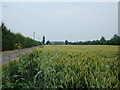
![Green Dike, Sherburn Enterprise Park [1] in LS25 6JL](https://images.propbar.co.uk/images/geograph/48/13/4813001_120.jpg)
18 photos from this area
Area Information
Key information about the LS25 6JL including its size, population, and administrative classification.
- Area Type
- Postcode
- Area Size
- 16.0 hectares
- Population
- 1555
- Population Density
- 138 people/km²
House Prices in LS25 6JL
7
Properties
£459,000
Average Sold Price
£287,000
Lowest Price
£650,000
Highest Price
Showing 7 properties
| Address | Type | Beds | Baths | Last Sale Price | Last Sale Date | |
|---|---|---|---|---|---|---|
| The Bungalow, Bishopdyke Road, Sherburn In Elmet, LS25 6JL | Bungalow | - | - | £650,000 | Jul 2023 | |
| The Nurseries, Bishopdyke Road, Sherburn In Elmet, LS25 6JL | Bungalow | 4 | - | £440,000 | Feb 2022 | |
| Mayfield, Bishopdyke Road, Sherburn In Elmet, LS25 6JL | Detached | 3 | 1 | £287,000 | Jan 2005 | |
| Whiteacres, Bishopdyke Road, Sherburn In Elmet, LS25 6JL | Detached | 3 | 1 | - | - | |
| Moorlane Nurseries, Bishopdyke Road, Sherburn In Elmet, LS25 6JL | undefined | 4 | - | - | - | |
| Thornleigh, Bishopdyke Road, Sherburn In Elmet, LS25 6JL | Detached | - | - | - | - | |
| Coin Cottage, Bishopdyke Road, Sherburn In Elmet, LS25 6JL | Detached | - | - | - | - |
Energy Efficiency in LS25 6JL
Amenities
Schools
| Rank | School | Type | Entry gender | Ages |
|---|
Explore more schools in this area
Go to Schools tabDemographics
Household Size
Two person
most common
Accommodation Type
Houses
most common
Tenure
82
majority
Ethnic Group
White
most common
Religion
N/A
most common
Household Composition
N/A
most common
Age
47
median
Adults (30-64 years)
most common
Household Deprivation
N/A
with no deprivation
NS-SEC
50
in Lower managerial occupations
Explore more demographic insights in this area
Go to Demographics tabPlanning
Planning Constraints
- Flood RiskPremium
- Ramsar Wetland SitesPremium
- Area of Outstanding Natural BeautyPremium
- Protected Nature ReservePremium
- Protected WoodlandPremium