Area Overview for LS25 6HJ
Photos of LS25 6HJ
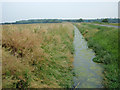

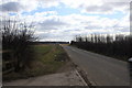
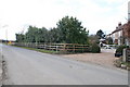
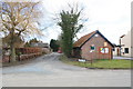
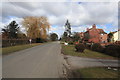
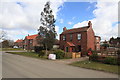
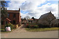
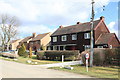
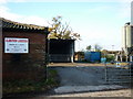
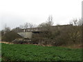
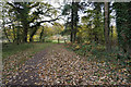
48 photos from this area
Area Information
Key information about the LS25 6HJ including its size, population, and administrative classification.
- Area Type
- Postcode
- Area Size
- 1.2 km²
- Population
- 1946
- Population Density
- 80 people/km²
House Prices in LS25 6HJ
41
Properties
£369,307
Average Sold Price
£132,500
Lowest Price
£800,000
Highest Price
Showing 41 properties
| Address | Type | Beds | Baths | Last Sale Price | Last Sale Date | |
|---|---|---|---|---|---|---|
| Bridge House, Oxmoor Lane, Biggin, LS25 6HJ | house | 4 | 3 | £750,000 | Apr 2024 | |
| The Croft, Oxmoor Lane, Biggin, LS25 6HJ | Detached | 4 | 2 | £600,000 | Feb 2023 | |
| Chapel Holme, Oxmoor Lane, Biggin, LS25 6HJ | house | 3 | - | £325,000 | Dec 2022 | |
| Rose Cottage, Oxmoor Lane, Biggin, LS25 6HJ | Detached | 6 | - | £345,000 | Aug 2017 | |
| The Carthouse, Oxmoor Lane, Biggin, LS25 6HJ | Detached | - | - | £800,000 | Nov 2016 | |
| Fairway, Oxmoor Lane, Biggin, LS25 6HJ | house | - | - | £354,000 | Feb 2015 | |
| The Granary, Oxmoor Lane, Biggin, LS25 6HJ | Terraced | - | - | £280,000 | May 2014 | |
| Primrose Cottage, Oxmoor Lane, Biggin, LS25 6HJ | Bungalow | 3 | - | £365,000 | Mar 2014 | |
| Ashtree, Oxmoor Lane, Biggin, LS25 6HJ | Detached | 4 | - | £249,950 | Oct 2013 | |
| Applegarth, Oxmoor Lane, Biggin, LS25 6HJ | Bungalow | - | - | £267,000 | Sep 2013 |
Page 1 of 5
Energy Efficiency in LS25 6HJ
Amenities
Schools
| Rank | School | Type | Entry gender | Ages |
|---|
Explore more schools in this area
Go to Schools tabDemographics
Household Size
Family (3-5 people)
most common
Accommodation Type
Houses
most common
Tenure
78
majority
Ethnic Group
White
most common
Religion
N/A
most common
Household Composition
N/A
most common
Age
47
median
Adults (30-64 years)
most common
Household Deprivation
N/A
with no deprivation
NS-SEC
43
in Lower managerial occupations
Explore more demographic insights in this area
Go to Demographics tabPlanning
Planning Constraints
- Flood RiskPremium
- Ramsar Wetland SitesPremium
- Area of Outstanding Natural BeautyPremium
- Protected Nature ReservePremium
- Protected WoodlandPremium