Area Overview for LS25 5YX
Photos of LS25 5YX


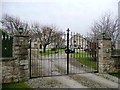
![Steeton Hall Gateway [or Steeton Gatehouse] in LS25 5YX](https://images.propbar.co.uk/images/geograph/27/36/2736639_120.jpg)
Area Information
LS25 5YX is a small, tightly knit residential postcode in England, home to 1,414 people spread across a low-density area with 79 residents per square kilometre. This is a quiet, established neighbourhood where the majority of residents are adults aged 30–64, reflecting a stable community with a median age of 47. The area is characterised by a predominance of owner-occupied homes, with 76% of properties owned by their occupants. This suggests a long-term presence of families and professionals who value stability. Daily life here is shaped by proximity to local amenities, including two primary schools and accessible rail links. The low population density means a slower pace of life compared to larger urban centres, with homes primarily set in traditional housing stock. Residents benefit from good broadband connectivity and a low crime risk, making it an attractive option for those seeking a secure, community-focused environment. The area’s small size means it is not densely developed, offering a balance between convenience and space.
- Area Type
- Postcode
- Area Size
- Not available
- Population
- 1414
- Population Density
- 79 people/km²
The property market in LS25 5YX is dominated by owner-occupied homes, with 76% of properties owned by their residents. This high rate of home ownership indicates a stable, long-term community with limited rental activity. The area is characterised by houses rather than flats or apartments, suggesting a mix of semi-detached and detached properties typical of suburban or rural settings. Given the small population and low density, the housing stock is likely to be limited in scale, with fewer properties available compared to larger towns. For buyers, this means a focus on individual homes rather than high-density developments. The area’s quiet, low-density nature may appeal to those seeking space and privacy, though the limited number of properties could mean fewer options for buyers. The predominance of owner-occupied homes also suggests a steady market with little turnover, which could influence pricing and availability.
House Prices in LS25 5YX
No properties found in this postcode.
Energy Efficiency in LS25 5YX
The lifestyle in LS25 5YX is shaped by its proximity to a range of amenities, including five retail outlets such as M&S Southlands BP, Aldi Sherburn in, and Spar. These shops provide convenience for daily errands, from groceries to fuel. The area’s rail links connect residents to nearby towns, enhancing access to broader leisure and cultural opportunities. While the data does not mention parks or recreational spaces, the low population density suggests potential for green spaces or open areas. The presence of two primary schools and a railway network indicates a balance between community needs and connectivity. For residents, this means a lifestyle that combines local convenience with the ability to travel further for specialist services or entertainment. The mix of retail, transport, and educational facilities supports a practical, family-friendly environment.
Amenities
Schools
Residents of LS25 5YX have access to two primary schools: South Milford Community Primary School and South Milford Primary School. Both are primary institutions, though no Ofsted ratings are provided in the data. The presence of two schools in close proximity offers families options for their children’s early education, potentially reducing travel times and providing variety in teaching approaches. Given the area’s focus on family living, these schools are likely central to the community’s appeal. The absence of secondary schools in the immediate vicinity may require residents to travel further for secondary education, but the proximity to rail links could mitigate this. The availability of two primary schools underscores the area’s suitability for families prioritising accessible schooling for younger children.
| Rank | School | Type | Entry gender | Ages |
|---|
Explore more schools in this area
Go to Schools tabDemographics
The population of LS25 5YX is predominantly adults aged 30–64, with a median age of 47. This indicates a mature, settled community where most residents are likely in their prime working years or nearing retirement. Home ownership is high at 76%, suggesting a strong presence of long-term residents rather than transient renters. The area is composed mainly of houses, reflecting a preference for standalone properties over flats or apartments. The predominant ethnic group is White, with no data provided on other demographics. The low population density of 79 people per square kilometre implies a spread-out, suburban feel rather than a compact urban setting. This demographic profile suggests a community focused on family living and stability, with limited diversity in age or household composition. The absence of specific data on deprivation or socioeconomic diversity means this analysis is limited to the figures provided.
Household Size
Accommodation Type
Tenure
Ethnic Group
Religion
Household Composition
Age
Household Deprivation
NS-SEC
Explore more demographic insights in this area
Go to Demographics tabPlanning
Planning Constraints
- Flood RiskPremium
- Ramsar Wetland SitesPremium
- Area of Outstanding Natural BeautyPremium
- Protected Nature ReservePremium
- Protected WoodlandPremium