Area Overview for LS25 5HW
Photos of LS25 5HW
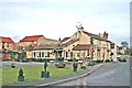
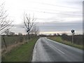
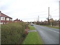
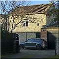
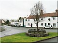
45 photos from this area
Area Information
Key information about the LS25 5HW including its size, population, and administrative classification.
- Area Type
- Postcode
- Area Size
- 42.6 hectares
- Population
- 1717
- Population Density
- 138 people/km²
House Prices in LS25 5HW
12
Properties
£406,600
Average Sold Price
£215,000
Lowest Price
£610,000
Highest Price
Showing 12 properties
| Address | Type | Beds | Baths | Last Sale Price | Last Sale Date | |
|---|---|---|---|---|---|---|
| Highfield House, Hillam Lane, Hillam, LS25 5HW | Detached | 4 | 3 | £450,000 | Jan 2024 | |
| Field View, Hillam Lane, Hillam, LS25 5HW | Detached | 5 | 4 | £610,000 | Oct 2023 | |
| Beech Lodge, Hillam Lane, Hillam, LS25 5HW | house | - | - | £440,000 | May 2021 | |
| Fir House, Hillam Lane, Hillam, LS25 5HW | Detached | 4 | 3 | £318,000 | Aug 2015 | |
| Surdales, Hillam Lane, Hillam, LS25 5HW | Detached | - | - | £215,000 | Jun 1999 | |
| Ten Acres, Hillam Lane, Hillam, LS25 5HW | Detached | 3 | 2 | - | - | |
| Akenfall Cottage, Hillam Lane, Hillam, LS25 5HW | Detached | 3 | 2 | - | - | |
| Glenhaven, Hillam Lane, Hillam, LS25 5HW | Semi-detached | - | - | - | - | |
| Border Farm, Hillam Lane, Hillam, LS25 5HW | retail_financial | - | - | - | - | |
| Holly Bank, Hillam Lane, Hillam, LS25 5HW | house | - | - | - | - |
Page 1 of 2
Energy Efficiency in LS25 5HW
Amenities
Schools
| Rank | School | Type | Entry gender | Ages |
|---|
Explore more schools in this area
Go to Schools tabDemographics
Household Size
Two person
most common
Accommodation Type
Houses
most common
Tenure
84
majority
Ethnic Group
White
most common
Religion
N/A
most common
Household Composition
N/A
most common
Age
47
median
Adults (30-64 years)
most common
Household Deprivation
N/A
with no deprivation
NS-SEC
49
in Lower managerial occupations
Explore more demographic insights in this area
Go to Demographics tabPlanning
Planning Constraints
- Flood RiskPremium
- Ramsar Wetland SitesPremium
- Area of Outstanding Natural BeautyPremium
- Protected Nature ReservePremium
- Protected WoodlandPremium