Area Overview for LS25 4XD
Photos of LS25 4XD
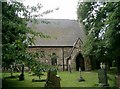
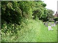
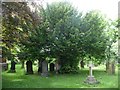
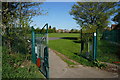
![Churchyard of St Mary the Virgin, Micklefield [1] in LS25 4XD](https://images.propbar.co.uk/images/geograph/19/10/1910031_120.jpg)
Area Information
LS25 4XD is a small residential postcode in England, home to 1,556 people spread across a compact area with a population density of 490 people per square kilometre. This is a tight-knit community, typical of smaller postcode clusters where neighbours are likely to know one another. The area’s character is shaped by its modest size and the demographic profile of its residents, who skew towards adults aged 30–64. Daily life here is likely to revolve around local amenities, family routines, and proximity to transport links. While not a sprawling suburb, the area offers a balance between residential tranquility and practical connectivity. The presence of nearby rail stations and retail outlets suggests that commuting and everyday shopping are easily managed. For those considering living in LS25 4XD, the appeal lies in its manageable scale, the availability of essential services, and the potential for a community-oriented lifestyle. However, its small footprint means that the housing market and local facilities are limited to what is immediately available, requiring buyers to assess whether the area’s offerings align with their needs.
- Area Type
- Postcode
- Area Size
- Not available
- Population
- 1556
- Population Density
- 490 people/km²
The property market in LS25 4XD is characterised by a 54% home ownership rate, indicating that nearly half of residents rent their homes. This suggests a mix of owner-occupied and rental properties, though the data does not specify the proportion of new versus older homes. The accommodation type is predominantly houses, which are likely to be larger properties compared to flats or apartments. This hints at a housing stock that caters to families or individuals seeking more space, though the small size of the area means the market is limited in scope. For buyers, this small postcode cluster may offer a niche opportunity, but the immediate surroundings are likely to be similarly constrained. The predominance of houses could mean that properties are more likely to be semi-detached or detached, potentially appealing to those prioritising privacy and space. However, the limited number of homes available may make the market competitive for those seeking to purchase within this specific area.
House Prices in LS25 4XD
No properties found in this postcode.
Energy Efficiency in LS25 4XD
The lifestyle in LS25 4XD is shaped by its proximity to essential amenities and services. Residents can access major retail outlets such as Lidl Garforth, Tesco Garforth, and Sainsburys Kippax, ensuring that daily shopping needs are met without long commutes. The rail network, with five stations nearby, including Micklefield and Garforth, provides easy access to public transport, supporting both local travel and longer journeys. For leisure and travel, Leeds East Airport is within reach, offering additional connectivity for those who require it. The area’s compact size means that these amenities are clustered closely, reducing the need for extensive travel. While the data does not mention parks or recreational spaces, the presence of rail stations and retail hubs suggests a lifestyle that prioritises convenience over expansive green spaces. The mix of retail, transport, and travel options creates a functional, accessible environment for residents, though the absence of detailed information on leisure facilities leaves some aspects of daily life unexplored.
Amenities
Schools
Residents of LS25 4XD have access to two primary schools: Micklefield Church of England Voluntary Controlled Primary School and Micklefield Church of England Primary Academy. Both are primary institutions, catering to younger children and offering foundational education. The presence of two primary schools suggests a focus on early education within the area, though the data does not provide Ofsted ratings or academic performance metrics. The mix of Voluntary Controlled and Academy statuses may reflect different governance models, but it does not necessarily indicate variation in quality. For families, this means two options for primary education, though the absence of secondary schools in the immediate vicinity could require commuting for older children. The proximity of these schools to LS25 4XD underscores the area’s appeal for families prioritising access to local education, though the broader school landscape remains unexplored in the data.
| Rank | School | Type | Entry gender | Ages |
|---|
Explore more schools in this area
Go to Schools tabDemographics
The population of LS25 4XD is predominantly composed of adults aged 30–64, with a median age of 47. This suggests a mature community, likely with established families and professionals in their mid-career. Home ownership is at 54%, meaning nearly half of residents rent, which may indicate a mix of owner-occupied properties and rental stock. The accommodation type is primarily houses, reflecting a preference for larger, standalone homes over flats or apartments. The predominant ethnic group is White, though the data does not provide further breakdowns on diversity. With a median age that excludes younger residents, the area may lack the vibrancy of a student population or the dynamism of a younger demographic. For quality of life, the absence of specific deprivation data means that the community’s socioeconomic profile remains opaque, but the home ownership rate and age distribution suggest a stable, middle-aged population with established routines and needs.
Household Size
Accommodation Type
Tenure
Ethnic Group
Religion
Household Composition
Age
Household Deprivation
NS-SEC
Explore more demographic insights in this area
Go to Demographics tabPlanning
Planning Constraints
- Flood RiskPremium
- Ramsar Wetland SitesPremium
- Area of Outstanding Natural BeautyPremium
- Protected Nature ReservePremium
- Protected WoodlandPremium