Area Overview for LS25 4DQ
Photos of LS25 4DQ
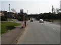
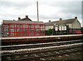
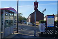
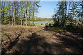
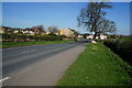
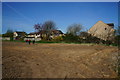
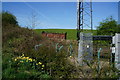
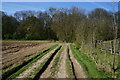
61 photos from this area
Area Information
Key information about the LS25 4DQ including its size, population, and administrative classification.
- Area Type
- Postcode
- Area Size
- 4.5 hectares
- Population
- 1556
- Population Density
- 490 people/km²
House Prices in LS25 4DQ
28
Properties
£131,649
Average Sold Price
£39,995
Lowest Price
£212,000
Highest Price
Showing 28 properties
| Address | Type | Beds | Baths | Last Sale Price | Last Sale Date | |
|---|---|---|---|---|---|---|
| 14 Sunnybank, Micklefield, Leeds, LS25 4DQ | Terraced | 3 | 2 | £197,500 | Feb 2025 | |
| 22 Sunnybank, Micklefield, Leeds, LS25 4DQ | Terraced | 4 | 1 | £212,000 | Sep 2023 | |
| 4 Sunnybank, Micklefield, Leeds, LS25 4DQ | house | - | - | £168,000 | Oct 2022 | |
| 9 Sunnybank, Micklefield, Leeds, LS25 4DQ | house | - | - | £160,000 | Jul 2022 | |
| 12 Sunnybank, Micklefield, Leeds, LS25 4DQ | house | - | - | £120,000 | Oct 2021 | |
| 18 Sunnybank, Micklefield, Leeds, LS25 4DQ | house | - | - | £128,000 | Apr 2021 | |
| 1 Sunnybank, Micklefield, Leeds, LS25 4DQ | Terraced | 4 | - | £124,995 | Aug 2015 | |
| 26 Sunnybank, Micklefield, Leeds, LS25 4DQ | Terraced | 4 | 1 | £117,000 | May 2015 | |
| 3 Sunnybank, Micklefield, Leeds, LS25 4DQ | Terraced | - | - | £48,995 | Sep 2001 | |
| 11 Sunnybank, Micklefield, Leeds, LS25 4DQ | Terraced | - | - | £39,995 | Jun 2001 |
Page 1 of 3
Energy Efficiency in LS25 4DQ
Amenities
Schools
| Rank | School | Type | Entry gender | Ages |
|---|
Explore more schools in this area
Go to Schools tabDemographics
Household Size
Two person
most common
Accommodation Type
Houses
most common
Tenure
54
majority
Ethnic Group
White
most common
Religion
N/A
most common
Household Composition
N/A
most common
Age
47
median
Adults (30-64 years)
most common
Household Deprivation
N/A
with no deprivation
NS-SEC
30
in Lower managerial occupations
Explore more demographic insights in this area
Go to Demographics tabPlanning
Planning Constraints
- Flood RiskPremium
- Ramsar Wetland SitesPremium
- Area of Outstanding Natural BeautyPremium
- Protected Nature ReservePremium
- Protected WoodlandPremium