Area Overview for LS25 3XA
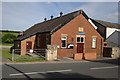
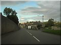
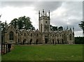
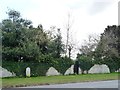
Photos of LS25 3XA
Area Information
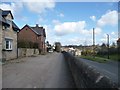
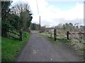
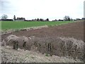
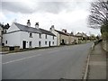
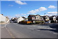
LS25 3XA is a small, tightly knit residential area in England, home to 1,724 people spread across a low-density settlement. The area’s compact size means it feels quiet and community-focused, with a population that skews towards adults aged 30–64. This is a place where homes are predominantly owner-occupied, with 80% of properties owned by residents rather than rented. Daily life here is shaped by proximity to essential services, including retail hubs like Lidl Garforth and Tesco Leeds, and easy access to rail networks such as Garforth Railway Station. The area’s modest size ensures a sense of familiarity, though its limited expansion means it remains a stable, unchanging environment. For those seeking a quieter life away from urban sprawl, LS25 3XA offers a balance of practicality and tranquillity, with no major environmental constraints or planning restrictions to complicate living here.
- Area Type
- Postcode
- Area Size
- Not available
- Population
- 1724
- Population Density
- 86 people/km²
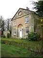
The property market in LS25 3XA is dominated by owner-occupied homes, with 80% of properties owned by residents. This suggests a community where long-term residency is common, rather than a transient rental market. The accommodation type is predominantly houses, which contrasts with areas where flats or apartments dominate. This housing stock likely appeals to families or individuals seeking more space and privacy. Given the area’s small size, the property market is likely limited in scope, with limited new developments or speculative investment. Buyers should consider that the area’s stability and low population density mean property values may not fluctuate significantly, but the availability of homes could be constrained by the postcode’s limited reach.
House Prices in LS25 3XA
No properties found in this postcode.
Energy Efficiency in LS25 3XA
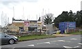
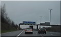
The lifestyle in LS25 3XA is shaped by its proximity to essential amenities. Retail options include Lidl Garforth, Tesco Leeds, and Co-op Garforth, ensuring everyday shopping needs are met within walking or short driving distance. The area’s rail network connects residents to nearby towns, while Leeds East Airport provides access to broader travel opportunities. Though the area is small, the mix of retail, transport, and regional connectivity creates a practical, low-stress environment. The absence of major leisure or entertainment hubs means the area is best suited for those prioritising convenience and simplicity over a bustling social scene.
Amenities
Schools
The nearest school to LS25 3XA is Aberford Church of England Voluntary Controlled Primary School, a primary school with a good Ofsted rating. This single school serves the local community, offering a solid foundation for young children’s education. The absence of secondary schools in the immediate vicinity means families may need to look further afield for secondary education, but the primary school’s high rating ensures a strong start. The school’s voluntary controlled status indicates it is partly funded by the local church, which may influence its ethos or community involvement. For parents prioritising a good primary school, this is a key asset of LS25 3XA, though additional research would be needed for secondary schooling options.
| Rank | School | Type | Entry gender | Ages |
|---|
Explore more schools in this area
Go to Schools tabDemographics
The population of LS25 3XA is predominantly middle-aged, with a median age of 47 and the largest age group being adults aged 30–64. This suggests a community of established residents, many of whom may be in their peak working years. Home ownership is high at 80%, indicating a stable, long-term demographic rather than a transient rental market. The area is largely composed of houses, which aligns with the typical housing stock of small rural or semi-rural postcode areas. The predominant ethnic group is White, though no specific data on diversity or deprivation is provided. The low population density of 86 people per square kilometre further reinforces the area’s quiet, low-traffic character, making it suitable for those prioritising space and privacy over densely populated urban settings.
Household Size
Accommodation Type
Tenure
Ethnic Group
Religion
Household Composition
Age
Household Deprivation
NS-SEC
Explore more demographic insights in this area
Go to Demographics tabPlanning
Planning Constraints
- Flood RiskPremium
- Ramsar Wetland SitesPremium
- Area of Outstanding Natural BeautyPremium
- Protected Nature ReservePremium
- Protected WoodlandPremium