Area Overview for LS25 3AR
Photos of LS25 3AR


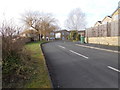
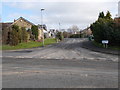
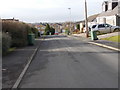
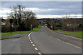
42 photos from this area
Area Information
Key information about the LS25 3AR including its size, population, and administrative classification.
- Area Type
- Postcode
- Area Size
- 2.0 hectares
- Population
- 1505
- Population Density
- 111 people/km²
House Prices in LS25 3AR
30
Properties
£250,455
Average Sold Price
£97,000
Lowest Price
£372,000
Highest Price
Showing 30 properties
| Address | Type | Beds | Baths | Last Sale Price | Last Sale Date | |
|---|---|---|---|---|---|---|
| 19 Greystones Close, Aberford, Leeds, LS25 3AR | Detached | 4 | 1 | £320,000 | May 2025 | |
| 23 Greystones Close, Aberford, Leeds, LS25 3AR | Detached | 3 | 2 | £365,000 | Apr 2024 | |
| 5 Greystones Close, Aberford, Leeds, LS25 3AR | Semi-detached | 3 | 2 | £276,000 | Aug 2023 | |
| 12 Greystones Close, Aberford, Leeds, LS25 3AR | Semi-detached | 3 | 1 | £285,000 | Oct 2022 | |
| 18 Greystones Close, Aberford, Leeds, LS25 3AR | Bungalow | 4 | - | £345,000 | Apr 2021 | |
| 27 Greystones Close, Aberford, Leeds, LS25 3AR | Detached | 4 | - | £342,500 | May 2020 | |
| 13 Greystones Close, Aberford, Leeds, LS25 3AR | Semi-detached | 3 | 1 | £245,000 | Jul 2019 | |
| 1 Greystones Close, Aberford, Leeds, LS25 3AR | Retail | 3 | 2 | £372,000 | Nov 2017 | |
| 24 Greystones Close, Aberford, Leeds, LS25 3AR | Detached | 5 | 3 | £310,000 | Sep 2015 | |
| 7 Greystones Close, Aberford, Leeds, LS25 3AR | Semi-detached | 3 | 1 | £155,000 | Apr 2015 |
Page 1 of 3
Energy Efficiency in LS25 3AR
Amenities
Schools
| Rank | School | Type | Entry gender | Ages |
|---|
Explore more schools in this area
Go to Schools tabDemographics
Household Size
Two person
most common
Accommodation Type
Houses
most common
Tenure
78
majority
Ethnic Group
White
most common
Religion
N/A
most common
Household Composition
N/A
most common
Age
47
median
Adults (30-64 years)
most common
Household Deprivation
N/A
with no deprivation
NS-SEC
44
in Lower managerial occupations
Explore more demographic insights in this area
Go to Demographics tabPlanning
Planning Constraints
- Flood RiskPremium
- Ramsar Wetland SitesPremium
- Area of Outstanding Natural BeautyPremium
- Protected Nature ReservePremium
- Protected WoodlandPremium