Area Overview for LS25 2XW
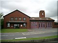
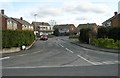
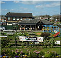
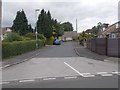
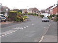
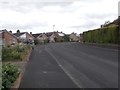
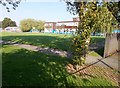
Photos of LS25 2XW

Area Information
LS25 2XW is a small, tightly knit residential postcode in England with a population of 1501, reflecting its modest scale. The area is characterised by a mature demographic, with a median age of 47 and the majority of residents falling within the 30-64 age range. This suggests a community of established adults, many of whom are likely to be homeowners, given the high home ownership rate of 84%. The area is predominantly composed of houses, indicating a traditional, low-density residential layout. Daily life here is likely to revolve around local amenities and proximity to transport links. While the area does not sit within any protected natural or cultural designations, its safety profile is strong, with a crime risk score of 94, placing it well below average. Residents benefit from excellent broadband connectivity, rated at 100, and practical access to rail stations, making it a viable choice for those prioritising both convenience and security in their living environment.
- Area Type
- Postcode
- Area Size
- Not available
- Population
- 1501
- Population Density
- 5456 people/km²
The property market in LS25 2XW is dominated by owner-occupied homes, with 84% of properties being owned by their residents. This high rate of home ownership indicates a stable, long-term community with limited rental activity. The accommodation type is primarily houses, which is uncommon in many urban areas but aligns with the area’s character as a small residential cluster. This suggests a focus on private, family-oriented living rather than high-density housing. For buyers, this means a market where properties are likely to be well-maintained and held by residents with a vested interest in the area’s upkeep. The limited scale of the area also means that properties are likely to be in close proximity to each other, offering a sense of community but potentially fewer options for buyers seeking variety in housing styles or sizes.
House Prices in LS25 2XW
No properties found in this postcode.
Energy Efficiency in LS25 2XW
The lifestyle in LS25 2XW is supported by a range of nearby amenities, including five rail stations such as East Garforth Station and Garforth Railway Station, which offer direct access to commuting routes. Retail options are conveniently available, with stores like Lidl Garforth, Tesco Garforth, and Tesco Leeds within practical reach. These shops provide essential grocery and retail services, reducing the need for long journeys to larger centres. While specific details on dining or leisure facilities are not provided, the presence of multiple retail outlets suggests a functional, community-focused environment. The area’s small scale means that daily needs are likely met locally, fostering a self-contained lifestyle. The absence of detailed data on parks or recreational areas means their availability remains unclear, but the existing amenities contribute to a practical, accessible living experience.
Amenities
Schools
| Rank | School | Type | Entry gender | Ages |
|---|
Explore more schools in this area
Go to Schools tabDemographics
The community in LS25 2XW is predominantly composed of adults aged 30-64, with a median age of 47. This indicates a population skewed towards middle-aged individuals, likely with established careers and families. Home ownership is exceptionally high at 84%, suggesting a stable, long-term resident base. The accommodation type is primarily houses, which aligns with the demographic profile of older, settled households. The predominant ethnic group is White, reflecting the broader regional composition. While no specific data on deprivation is provided, the high home ownership and low crime risk imply a relatively affluent and secure environment. This combination of factors suggests a community with strong social cohesion and a focus on long-term residency over transient living.
Household Size
Accommodation Type
Tenure
Ethnic Group
Religion
Household Composition
Age
Household Deprivation
NS-SEC
Explore more demographic insights in this area
Go to Demographics tabPlanning
Planning Constraints
- Flood RiskPremium
- Ramsar Wetland SitesPremium
- Area of Outstanding Natural BeautyPremium
- Protected Nature ReservePremium
- Protected WoodlandPremium