Area Overview for LS25 2XR
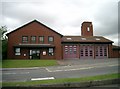
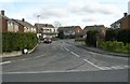
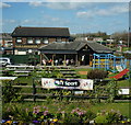
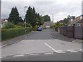
Photos of LS25 2XR

Area Information
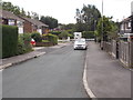
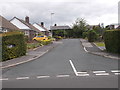
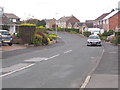
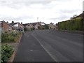
LS25 2XR is a small, tightly knit residential area in England, home to around 1500 people. Its compact size means it feels like a close-knit community, where daily life is shaped by proximity to local amenities and a stable demographic profile. The area’s population is predominantly adults aged 30–64, with a median age of 47, suggesting a mature, settled population. Most residents own their homes, reflecting a strong sense of permanence. The area’s low flood risk and absence of protected natural sites make it a practical choice for those prioritising safety and ease of planning. Nearby, rail stations such as East Garforth and Garforth Railway Station provide easy access to commuting routes, while local retail outlets like Tesco Garforth and Lidl ensure everyday needs are met. Life here balances quiet residential living with practical connectivity, making it appealing to those seeking stability without isolation.
- Area Type
- Postcode
- Area Size
- Not available
- Population
- 1501
- Population Density
- 5456 people/km²
The property market in LS25 2XR is dominated by owner-occupied homes, with 84% of properties in private ownership. This high rate of home ownership suggests a community where residents are invested in long-term stability, rather than a transient rental market. The accommodation type is primarily houses, which is typical of smaller, residential postcode areas. This housing stock likely includes family homes and semi-detached properties, catering to the area’s mature population. For buyers, this means a focus on established properties rather than newer developments. The small size of the area means property availability is limited, so buyers may need to consider nearby postcodes for more options. The lack of planning constraints or protected sites also simplifies the purchasing process, making it a practical choice for those seeking a settled, low-maintenance home.
House Prices in LS25 2XR
No properties found in this postcode.
Energy Efficiency in LS25 2XR
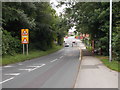
Daily life in LS25 2XR is shaped by its proximity to essential amenities. The area’s retail offerings include Lidl Garforth, Tesco Garforth, and Tesco Leeds, providing convenient access to groceries and everyday essentials. These stores are within practical reach, reducing the need for long journeys. The rail network, with stations such as East Garforth and Garforth Railway Station, adds to the area’s connectivity, enabling easy travel for work or leisure. While the data does not specify dining or leisure options, the presence of multiple retail outlets suggests a functional, community-focused environment. The area’s small size means amenities are concentrated, fostering a sense of convenience and accessibility. This practical layout supports a lifestyle where residents can meet daily needs without leaving the immediate vicinity.
Amenities
Schools
| Rank | School | Type | Entry gender | Ages |
|---|
Explore more schools in this area
Go to Schools tabDemographics
The community in LS25 2XR is characterised by a median age of 47, with the majority of residents falling within the 30–64 age range. This suggests a population largely composed of working-age adults and families, contributing to a stable, long-term demographic. Home ownership is high, with 84% of properties owned by their occupants, indicating a preference for settled living rather than rental tenancies. The area is predominantly occupied by White residents, with no significant data on other ethnic groups. The accommodation is largely houses, reflecting a low-density, family-oriented housing stock. This profile supports a community where neighbours are likely to be long-term residents, fostering familiarity and continuity. The absence of specific deprivation data means the area’s quality of life can be inferred from its low crime risk and practical amenities, which align with the needs of its mature, home-owning population.
Household Size
Accommodation Type
Tenure
Ethnic Group
Religion
Household Composition
Age
Household Deprivation
NS-SEC
Explore more demographic insights in this area
Go to Demographics tabPlanning
Planning Constraints
- Flood RiskPremium
- Ramsar Wetland SitesPremium
- Area of Outstanding Natural BeautyPremium
- Protected Nature ReservePremium
- Protected WoodlandPremium