Area Overview for LS25 1WP
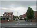
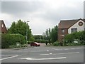
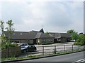
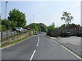
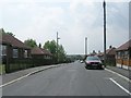
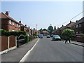
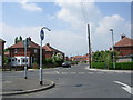
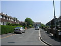
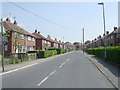
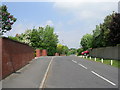
Photos of LS25 1WP


Area Information
LS25 1WP is a small, tightly knit residential cluster in England, home to 1,888 residents. The area’s compact nature means it balances quiet living with practical access to nearby amenities. With a median age of 47 and a strong presence of adults aged 30–64, the community leans towards established families and professionals. The area is predominantly composed of houses, with 55% of properties owner-occupied, suggesting a stable, long-term resident base. Daily life here is shaped by proximity to key services: a primary school, retail outlets, and rail links. While the postcode is small, it sits within a broader network of towns and villages, offering a blend of local convenience and regional connectivity. The low flood risk and absence of environmental restrictions like AONB or protected woodlands make it an attractive option for buyers seeking a straightforward, low-maintenance environment. However, the medium crime risk score of 57 means residents should maintain standard security measures. For those prioritising safety, practicality, and a settled community, LS25 1WP offers a focused, manageable living space.
- Area Type
- Postcode
- Area Size
- Not available
- Population
- 1888
- Population Density
- 2020 people/km²
LS25 1WP is primarily a house-dominated area, with 55% of properties owner-occupied. This suggests a stable market where long-term residents are more common than short-term renters. The focus on houses, rather than flats or apartments, aligns with the area’s mature demographic, which includes many families and older professionals. Given the small size of the postcode, the housing stock is likely limited in volume, making it a niche market for buyers seeking a quiet, low-density environment. The absence of planning constraints like AONB or protected woodlands means development restrictions are minimal, though the area’s small size may limit expansion. For buyers, this means properties are likely to be individually distinct, with fewer high-density options. The owner-occupation rate also implies that rental availability is lower, potentially making the area more attractive to those prioritising long-term investment over short-term letting.
House Prices in LS25 1WP
No properties found in this postcode.
Energy Efficiency in LS25 1WP
The lifestyle in LS25 1WP is shaped by its proximity to essential amenities. Retail options include Budgens Main, Co-op Garforth, and Tesco Leeds, providing access to groceries and everyday essentials. These shops cater to both daily needs and occasional shopping trips, ensuring convenience for residents. The rail stations—Garforth, East Garforth, and Micklefield—enhance mobility, connecting the area to broader networks for commuting or leisure. While the data does not mention parks or leisure facilities, the presence of retail and transport links suggests a practical, service-oriented lifestyle. The area’s small size means amenities are tightly clustered, reducing the need for long commutes. For those valuing accessibility and a straightforward, functional environment, LS25 1WP offers a balance of local convenience and regional connectivity.
Amenities
Schools
The nearest school to LS25 1WP is Garforth Barley Hill Infant School, a primary institution. While no secondary schools are listed in the data, the presence of a primary school indicates that families with young children have access to local education. The school’s type suggests it caters to younger students, though the absence of secondary options means families may need to look beyond the immediate area for older children’s schooling. The single primary school available may serve multiple nearby postcodes, potentially creating a shared community focus around education. However, the data does not provide Ofsted ratings or academic performance metrics, so parents would need to investigate further for detailed insights. For those prioritising proximity to schools, the availability of a primary institution is a practical advantage, though secondary education options remain a consideration for long-term family planning.
| Rank | School | Type | Entry gender | Ages |
|---|
Explore more schools in this area
Go to Schools tabDemographics
The population of LS25 1WP is 1,888, with a median age of 47. The most common age range is adults aged 30–64, reflecting a mature, established community. Home ownership stands at 55%, indicating a mix of owner-occupied and rental properties. The area is predominantly composed of houses, aligning with the demographic profile of older, settled residents. The predominant ethnic group is White, though no further breakdown of diversity is provided. The age profile suggests a focus on families and professionals, with fewer younger or retired residents. This demographic structure influences local services and amenities, which cater to the needs of working-age adults and school-age children. The absence of specific data on deprivation means the quality of life here is likely shaped by the stability of the housing stock and the availability of nearby infrastructure. The community’s character is defined by its maturity, with a strong emphasis on practical living over transient or youthful dynamics.
Household Size
Accommodation Type
Tenure
Ethnic Group
Religion
Household Composition
Age
Household Deprivation
NS-SEC
Explore more demographic insights in this area
Go to Demographics tabPlanning
Planning Constraints
- Flood RiskPremium
- Ramsar Wetland SitesPremium
- Area of Outstanding Natural BeautyPremium
- Protected Nature ReservePremium
- Protected WoodlandPremium