Area Overview for LS24 9WT
Photos of LS24 9WT


Area Information
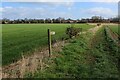
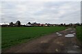
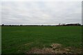
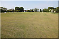
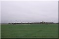
LS24 9WT is a small, tightly knit residential postcode in England, home to 1946 people spread across 80 people per square kilometre. This compact area blends quiet living with practical access to nearby services, making it appealing for those seeking a balanced lifestyle. The community is predominantly composed of adults aged 30–64, reflecting a mature demographic that values stability. Daily life here is characterised by proximity to essential amenities, from local shops to rail links, while the low population density ensures a sense of space without urban congestion. The area’s small size means it is easy to navigate on foot or by bike, and its location near major transport routes connects residents to broader regional networks. With no significant environmental constraints or planning restrictions, LS24 9WT offers a straightforward, low-maintenance living environment. Whether you’re commuting to nearby towns or enjoying the quiet of a residential cluster, this postcode provides a foundation for a practical, community-focused lifestyle.
- Area Type
- Postcode
- Area Size
- Not available
- Population
- 1946
- Population Density
- 80 people/km²
LS24 9WT is primarily an owner-occupied area, with 78% of properties held by residents rather than landlords. The accommodation type is predominantly houses, which is unusual for a small postcode but suggests a focus on single-family homes. This composition indicates a market where property buyers are likely seeking long-term investment rather than short-term rental returns. The high home ownership rate and presence of houses point to a community that values privacy and space, though the small size of the area means the housing stock is limited. Buyers should consider the proximity to nearby amenities, such as schools and retail, which may influence property values. The absence of rental properties also means the market is less influenced by fluctuating demand from tenants. For those looking to purchase, the area’s compact nature offers a straightforward, low-maintenance environment, though the limited supply may mean competition for available homes.
House Prices in LS24 9WT
No properties found in this postcode.
Energy Efficiency in LS24 9WT
The lifestyle in LS24 9WT is supported by a selection of nearby amenities, including five retail outlets such as Co-op Sherburn-In, Spar, and Tesco Sherburn. These shops provide access to everyday essentials, making the area convenient for residents who prefer to shop locally. While no parks or leisure facilities are explicitly listed, the presence of multiple retail options suggests a community that values practicality and accessibility. The small size of the postcode means amenities are within walking or cycling distance, reducing the need for lengthy commutes. The mix of retail choices, from supermarkets to smaller convenience stores, reflects a practical approach to daily living. For those who enjoy a self-contained lifestyle, LS24 9WT offers the essentials without the need to travel far, supporting a low-maintenance, community-focused way of life.
Amenities
Schools
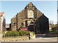
Residents of LS24 9WT have access to two primary schools: Kirk Fenton Parochial Church of England Voluntary Controlled Primary School and Kirk Fenton Church of England Primary School. Both institutions serve the local community, providing education for younger children in the area. The presence of two primary schools within practical reach is a significant advantage for families, reducing the need for long commutes to education. While no Ofsted ratings are provided, the fact that both schools are church-affiliated may indicate a focus on community values and religious education. For parents seeking a stable, localised education system, these schools offer a reliable option. The dual availability of primary schools also suggests a well-established educational infrastructure, which can be a key consideration for families prioritising proximity to schools.
| Rank | School | Type | Entry gender | Ages |
|---|
Explore more schools in this area
Go to Schools tabDemographics
The population of LS24 9WT is 1946, with a median age of 47 and the majority of residents falling within the 30–64 age range. This suggests a community of established adults, many of whom may be in their prime working years or nearing retirement. Home ownership is high, with 78% of properties occupied by owners, indicating a stable, long-term resident base. The predominant accommodation type is houses, which aligns with the area’s low population density and suggests a focus on family-friendly living. The predominant ethnic group is White, though no data on diversity or deprivation levels is provided. The age profile and ownership rates imply a neighbourhood where residents prioritise security and continuity, with fewer transient populations. This demographic structure supports a cohesive community dynamic, where local services and amenities are likely tailored to the needs of middle-aged and older residents.
Household Size
Accommodation Type
Tenure
Ethnic Group
Religion
Household Composition
Age
Household Deprivation
NS-SEC
Explore more demographic insights in this area
Go to Demographics tabPlanning
Planning Constraints
- Flood RiskPremium
- Ramsar Wetland SitesPremium
- Area of Outstanding Natural BeautyPremium
- Protected Nature ReservePremium
- Protected WoodlandPremium