Area Overview for LS24 9JA
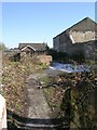
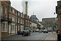
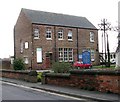
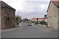
Photos of LS24 9JA


Area Information
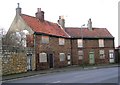
LS24 9JA is a small residential postcode area in England, home to 1,156 residents. Its compact size means it is a tightly knit community, with homes primarily located in a single cluster. The area’s character is defined by its quiet, suburban feel, with a population skewed toward adults aged 30-64. This suggests a mature demographic, likely with established careers and families. Daily life here is shaped by proximity to local amenities and schools, with a focus on practical living. The area’s small footprint means residents are likely to know their neighbours, creating a close-knit environment. While it lacks the density of larger towns, its charm lies in its simplicity and the ease of access to nearby services. The absence of major planning constraints or environmental risks adds to its appeal, offering a stable, low-maintenance lifestyle. For those seeking a peaceful, community-oriented home without the complexities of urban living, LS24 9JA provides a straightforward alternative.
- Area Type
- Postcode
- Area Size
- Not available
- Population
- 1156
- Population Density
- 1171 people/km²
The property market in LS24 9JA is characterised by a high rate of home ownership (67%) and a predominance of houses over flats. This suggests a market skewed toward owner-occupied homes, with limited rental activity. The small area size means the housing stock is likely limited, making properties here relatively scarce. For buyers, this translates to a niche market where demand may outstrip supply, particularly for families seeking larger, more private homes. The absence of flats indicates a focus on traditional housing, which may appeal to those prioritising space and long-term investment. However, the limited number of properties also means competition could be fierce, and buyers may need to act quickly. The area’s low crime risk and proximity to amenities further enhance its desirability, though its small size means it is best suited for those content with a compact, community-focused lifestyle.
House Prices in LS24 9JA
No properties found in this postcode.
Energy Efficiency in LS24 9JA
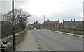
The lifestyle in LS24 9JA is shaped by its proximity to essential amenities. Residents can access a range of retail options, including Morrisons Daily, Sainsburys Tadcaster, and Co-op Copmanthorpe, ensuring daily needs are met locally. The three nearby railway stations—Ulleskelf, Church Fenton, and Sherburn—provide reliable transport links to surrounding towns and cities. While the area lacks large leisure facilities, its small footprint means amenities are within walking or short driving distance. The presence of multiple primary schools also contributes to a family-friendly environment. The character of LS24 9JA is defined by its simplicity and practicality, with no grand attractions but a focus on convenience. For those prioritising ease of access to shops, transport, and education, this area offers a straightforward, no-frills lifestyle.
Amenities
Schools
Residents of LS24 9JA have access to several primary schools, including Tadcaster, Riverside Community Primary School, St Joseph’s Catholic Primary School, and Riverside School, Tadcaster, which is an academy. These institutions provide a mix of community-run and academy-led education, offering families options between traditional and academically focused environments. The presence of multiple primary schools within practical reach suggests a strong local education network, though no secondary schools are listed. For families, this means proximity to early education but may require travel for older children. The variety of school types allows parents to choose between community-based settings and academies, which often have distinct curricula or specialisms. However, the data does not specify Ofsted ratings, so further research would be needed to assess individual school performance.
| Rank | School | Type | Entry gender | Ages |
|---|
Explore more schools in this area
Go to Schools tabDemographics
The population of LS24 9JA has a median age of 47, with the most common age range being adults aged 30-64. This indicates a community of middle-aged individuals, likely in their prime working years, with fewer young families or retirees. Home ownership is high, at 67%, suggesting a stable, long-term resident base. The area is predominantly composed of houses rather than flats, which aligns with the demographic profile of older, established households. The predominant ethnic group is White, reflecting a homogenous community. While no specific deprivation data is provided, the high home ownership rate and low crime risk (score 80) imply a relatively affluent and secure environment. This demographic profile suggests a lifestyle focused on stability, with residents prioritising property ownership and community cohesion over transient living arrangements.
Household Size
Accommodation Type
Tenure
Ethnic Group
Religion
Household Composition
Age
Household Deprivation
NS-SEC
Explore more demographic insights in this area
Go to Demographics tabPlanning
Planning Constraints
- Flood RiskPremium
- Ramsar Wetland SitesPremium
- Area of Outstanding Natural BeautyPremium
- Protected Nature ReservePremium
- Protected WoodlandPremium