Area Overview for LS24 8XG
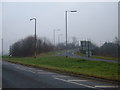
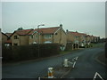
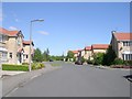
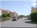
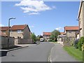
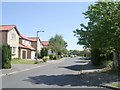
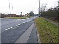
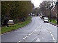
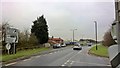
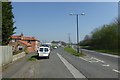
Photos of LS24 8XG
Area Information
LS24 8XG is a small, tightly knit residential postcode in England, home to 1,083 people spread across a compact area. With a population density of 247 people per square kilometre, it reflects a quiet, low-rise community characterised by a focus on private homes. The area’s appeal lies in its balance of practicality and proximity to essential services. Residents benefit from nearby retail options such as Sainsburys in Tadcaster and Co-op in Copmanthorpe, while railway stations at Ulleskelf and Church Fenton offer connections to wider networks. The postcode’s small size means it is likely to feel more like a village than a sprawling suburb, with a sense of familiarity among neighbours. Daily life here is shaped by the presence of local shops, the ease of rail travel, and the low crime risk, which contributes to a generally secure environment. For those seeking a place with a manageable population and accessible amenities, LS24 8XG offers a straightforward, no-frills living experience.
- Area Type
- Postcode
- Area Size
- Not available
- Population
- 1083
- Population Density
- 247 people/km²
The property market in LS24 8XG is dominated by owner-occupied homes, with 81% of properties owned by their residents. This high rate of home ownership suggests a community of long-term residents rather than a transient rental market. The area is primarily composed of houses, which may indicate a preference for larger, more private living spaces over flats or apartments. For buyers, this means the available housing stock is likely to be limited in quantity but focused on individual properties rather than high-density developments. The small size of the postcode means that properties are likely to be closely spaced, and the immediate surroundings may offer similar characteristics. Buyers should consider that the market is not driven by short-term rental demand but by those seeking a permanent residence in a low-risk, stable area.
House Prices in LS24 8XG
No properties found in this postcode.
Energy Efficiency in LS24 8XG
Living in LS24 8XG offers access to a range of local amenities within walking or short driving distance. The retail sector includes Sainsburys in Tadcaster, Morrisons Daily, and Co-op in Copmanthorpe, providing essential shopping options for daily needs. The area’s proximity to Ulleskelf and Church Fenton railway stations allows for easy travel to nearby towns and cities. Leeds East Airport is also nearby, offering regional air connectivity. While the data does not specify parks or leisure facilities, the presence of retail and transport hubs suggests a focus on practicality over large-scale recreational spaces. The small size of the postcode means that amenities are concentrated, creating a self-contained environment where residents can access basic services without long commutes.
Amenities
Schools
| Rank | School | Type | Entry gender | Ages |
|---|
Explore more schools in this area
Go to Schools tabDemographics
The community in LS24 8XG is predominantly middle-aged, with a median age of 47 and the majority of residents falling within the 30-64 age range. This suggests a stable population with a strong presence of working-age adults and families. Home ownership is high, at 81%, indicating that most residents are long-term residents rather than renters. The area is largely composed of houses, which aligns with the demographic profile of established households. The predominant ethnic group is White, reflecting a homogenous community. While specific data on deprivation is not provided, the high home ownership rate and low crime risk imply a relatively stable quality of life. The absence of significant demographic diversity may appeal to those seeking a consistent, low-competition environment.
Household Size
Accommodation Type
Tenure
Ethnic Group
Religion
Household Composition
Age
Household Deprivation
NS-SEC
Explore more demographic insights in this area
Go to Demographics tabPlanning
Planning Constraints
- Flood RiskPremium
- Ramsar Wetland SitesPremium
- Area of Outstanding Natural BeautyPremium
- Protected Nature ReservePremium
- Protected WoodlandPremium