Area Overview for LS24 8AF
Photos of LS24 8AF
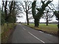
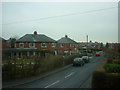
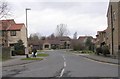
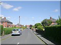
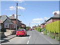
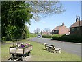
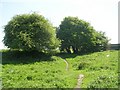
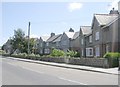
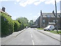
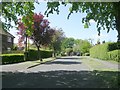
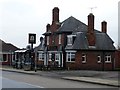
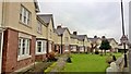
64 photos from this area
Area Information
Key information about the LS24 8AF including its size, population, and administrative classification.
- Area Type
- Postcode
- Area Size
- 1.1 hectares
- Population
- 1477
- Population Density
- 2511 people/km²
House Prices in LS24 8AF
34
Properties
£161,046
Average Sold Price
£39,500
Lowest Price
£455,000
Highest Price
Showing 34 properties
| Address | Type | Beds | Baths | Last Sale Price | Last Sale Date | |
|---|---|---|---|---|---|---|
| 54 York Road, Tadcaster, LS24 8AF | Semi-detached | 4 | 1 | £285,000 | Jan 2025 | |
| 70 York Road, Tadcaster, LS24 8AF | Cottage | 3 | 2 | £230,000 | May 2024 | |
| 50 York Road, Tadcaster, LS24 8AF | Retail | 4 | 1 | £455,000 | Sep 2022 | |
| 48 York Road, Tadcaster, LS24 8AF | Terraced | 2 | 1 | £187,000 | Jul 2022 | |
| 72 York Road, Tadcaster, LS24 8AF | Detached | 2 | 2 | £170,000 | Dec 2021 | |
| 42 York Road, Tadcaster, LS24 8AF | Terraced | 3 | 1 | £126,000 | Jul 2020 | |
| 4 York Road, Tadcaster, LS24 8AF | Terraced | 2 | - | £85,270 | Oct 2017 | |
| 28 York Road, Tadcaster, LS24 8AF | Terraced | 2 | - | £122,000 | Jan 2017 | |
| 44 York Road, Tadcaster, LS24 8AF | house | - | - | £127,000 | Jan 2015 | |
| 26 York Road, Tadcaster, LS24 8AF | house | 3 | - | £110,000 | Feb 2011 |
Page 1 of 4
Energy Efficiency in LS24 8AF
Amenities
Schools
| Rank | School | Type | Entry gender | Ages |
|---|
Explore more schools in this area
Go to Schools tabDemographics
Household Size
One person
most common
Accommodation Type
Houses
most common
Tenure
59
majority
Ethnic Group
White
most common
Religion
N/A
most common
Household Composition
N/A
most common
Age
47
median
Adults (30-64 years)
most common
Household Deprivation
N/A
with no deprivation
NS-SEC
25
in Lower managerial occupations
Explore more demographic insights in this area
Go to Demographics tabPlanning
Planning Constraints
- Flood RiskPremium
- Ramsar Wetland SitesPremium
- Area of Outstanding Natural BeautyPremium
- Protected Nature ReservePremium
- Protected WoodlandPremium