Area Overview for LS23 7RR
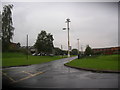
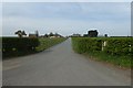
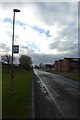
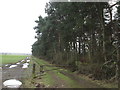
Photos of LS23 7RR


Area Information
LS23 7RR is a small residential postcode area in England, home to 2,285 people spread across a low-density neighbourhood with 168 residents per square kilometre. This compact cluster is characterised by a quiet, suburban feel, with a focus on private homes rather than high-rise or shared accommodation. The area’s population skews towards adults aged 30–64, reflecting a mature community with strong ties to local amenities. Daily life here is defined by proximity to essential services, including retail outlets and rail networks, which provide both convenience and connectivity. While the area does not sit within protected natural sites or areas of outstanding beauty, its low flood risk and absence of planning constraints make it a practical choice for those prioritising safety and ease of development. Living in LS23 7RR offers a balance of residential tranquillity and access to nearby towns, making it suitable for families or individuals seeking a stable, low-maintenance environment.
- Area Type
- Postcode
- Area Size
- Not available
- Population
- 2285
- Population Density
- 168 people/km²
The property market in LS23 7RR is dominated by owner-occupied homes, with 74% of residents living in properties they own. This high rate of home ownership points to a stable, long-term resident base rather than a transient rental market. The accommodation type is primarily houses, which is typical for a low-density, suburban area. This suggests that the housing stock consists of detached or semi-detached homes, offering more space and privacy compared to apartments. For buyers, this means a focus on individual properties rather than flats or shared housing. The small size of the area and its proximity to nearby towns may also mean that property values are influenced by local amenities and transport links. Buyers should consider the limited scale of the area when exploring nearby options.
House Prices in LS23 7RR
No properties found in this postcode.
Energy Efficiency in LS23 7RR
The lifestyle in LS23 7RR is supported by nearby amenities that cater to everyday needs. Within practical reach are five retail outlets, including Sainsburys in Tadcaster, Morrisons Daily, and M&S in Wetherby. These shops provide access to groceries, clothing, and other essentials, reducing the need for long trips. The area is also served by three rail stations, offering connections to regional hubs and facilitating travel for work or leisure. While the data does not mention parks or leisure facilities, the presence of retail and transport options suggests a convenient, functional lifestyle. The combination of local shops and rail links ensures that residents can meet their daily needs without significant travel, contributing to a practical, low-stress environment.
Amenities
Schools
The nearest school to LS23 7RR is Lady Elizabeth Hastings’ CofE VA Primary School in Thorp Arch, a primary school with a good Ofsted rating. This provides families with access to a well-regarded early education institution, though no secondary schools are listed in the data. The presence of a primary school with a good rating is a key consideration for parents, offering reassurance about the quality of education available. However, families requiring secondary schooling may need to look further afield, potentially increasing commuting times. The school’s location in Thorp Arch also suggests that the area is part of a broader network of educational facilities, though specific details about other schools are not provided.
| Rank | School | Type | Entry gender | Ages |
|---|
Explore more schools in this area
Go to Schools tabDemographics
The community in LS23 7RR is predominantly composed of adults aged 30–64, with a median age of 47. This suggests a population that is largely settled, with fewer young families or retirees compared to other areas. Home ownership is high at 74%, indicating a strong presence of long-term residents and a stable property market. The accommodation type is primarily houses, which aligns with the area’s low population density and suburban character. The predominant ethnic group is White, reflecting a homogenous demographic profile. While no specific data on deprivation is provided, the high home ownership rate and age distribution suggest a community with relatively stable economic conditions. This profile may appeal to those seeking a mature, low-traffic environment with established housing stock.
Household Size
Accommodation Type
Tenure
Ethnic Group
Religion
Household Composition
Age
Household Deprivation
NS-SEC
Explore more demographic insights in this area
Go to Demographics tabPlanning
Planning Constraints
- Flood RiskPremium
- Ramsar Wetland SitesPremium
- Area of Outstanding Natural BeautyPremium
- Protected Nature ReservePremium
- Protected WoodlandPremium