Area Overview for LS22 7FY
Photos of LS22 7FY
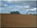
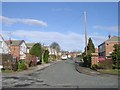
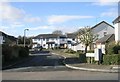

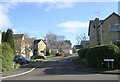
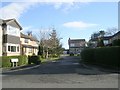
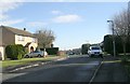
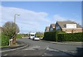
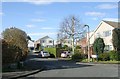
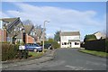
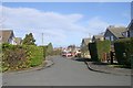
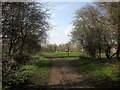
65 photos from this area
Area Information
Key information about the LS22 7FY including its size, population, and administrative classification.
- Area Type
- Postcode
- Area Size
- 2.5 hectares
- Population
- 1289
- Population Density
- 3925 people/km²
House Prices in LS22 7FY
40
Properties
£294,513
Average Sold Price
£85,000
Lowest Price
£507,500
Highest Price
Showing 40 properties
| Address | Type | Beds | Baths | Last Sale Price | Last Sale Date | |
|---|---|---|---|---|---|---|
| 78 Ainsty Road, Wetherby, LS22 7FY | Detached | 4 | 2 | £405,000 | Mar 2025 | |
| 92 Ainsty Road, Wetherby, LS22 7FY | Detached | 4 | 3 | £427,000 | Mar 2025 | |
| 68 Ainsty Road, Wetherby, LS22 7FY | house | - | - | £490,000 | Oct 2023 | |
| 90 Ainsty Road, Wetherby, LS22 7FY | house | - | - | £507,500 | Feb 2023 | |
| 84 Ainsty Road, Wetherby, LS22 7FY | house | - | - | £449,500 | Jan 2021 | |
| 123 Ainsty Road, Wetherby, LS22 7FY | Detached | 4 | 3 | £335,000 | Sep 2020 | |
| 127 Ainsty Road, Wetherby, LS22 7FY | house | - | - | £337,500 | Dec 2019 | |
| 121 Ainsty Road, Wetherby, LS22 7FY | Detached | 5 | - | £435,000 | Feb 2019 | |
| 86 Ainsty Road, Wetherby, LS22 7FY | Bungalow | - | - | £349,950 | Nov 2018 | |
| 115 Ainsty Road, Wetherby, LS22 7FY | Detached | 4 | - | £372,000 | Sep 2018 |
Page 1 of 4
Energy Efficiency in LS22 7FY
Amenities
Schools
| Rank | School | Type | Entry gender | Ages |
|---|
Explore more schools in this area
Go to Schools tabDemographics
Household Size
Two person
most common
Accommodation Type
Houses
most common
Tenure
88
majority
Ethnic Group
White
most common
Religion
N/A
most common
Household Composition
N/A
most common
Age
47
median
Adults (30-64 years)
most common
Household Deprivation
N/A
with no deprivation
NS-SEC
46
in Lower managerial occupations
Explore more demographic insights in this area
Go to Demographics tabPlanning
Planning Constraints
- Flood RiskPremium
- Ramsar Wetland SitesPremium
- Area of Outstanding Natural BeautyPremium
- Protected Nature ReservePremium
- Protected WoodlandPremium