Area Overview for LS22 4HH
Photos of LS22 4HH

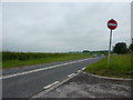


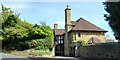

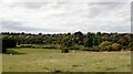


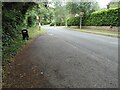

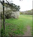
27 photos from this area
Area Information
Key information about the LS22 4HH including its size, population, and administrative classification.
- Area Type
- Postcode
- Area Size
- 13.5 hectares
- Population
- 1648
- Population Density
- 869 people/km²
House Prices in LS22 4HH
13
Properties
£1,268,864
Average Sold Price
£345,000
Lowest Price
£2,850,000
Highest Price
Showing 13 properties
| Address | Type | Beds | Baths | Last Sale Price | Last Sale Date | |
|---|---|---|---|---|---|---|
| Keldale, Linton Lane, Linton, Wetherby, LS22 4HH | Detached | 5 | - | £2,050,000 | Jul 2024 | |
| Knighton Lodge, Linton Lane, Linton, Wetherby, LS22 4HH | house | - | - | £1,530,000 | Aug 2022 | |
| High Croft, Linton Lane, Linton, Wetherby, LS22 4HH | house | - | - | £2,500,000 | Oct 2020 | |
| Spring Hill, Linton Lane, Linton, Wetherby, LS22 4HH | Bungalow | - | - | £1,300,000 | Oct 2020 | |
| Burndell, Linton Lane, Linton, Wetherby, LS22 4HH | Detached | 4 | - | £962,500 | Sep 2016 | |
| The Quillet, Linton Lane, Linton, Wetherby, LS22 4HH | Detached | 7 | - | £2,850,000 | Jan 2015 | |
| The Cedars, Linton Lane, Linton, Wetherby, LS22 4HH | Detached | - | - | £575,000 | Jun 2000 | |
| Linfield House, Linton Lane, Linton, Wetherby, LS22 4HH | house | - | - | £475,000 | Mar 2000 | |
| Meadow Rise, Linton Lane, Linton, Wetherby, LS22 4HH | Detached | - | - | £565,000 | Aug 1999 | |
| Rough Hills, Linton Lane, Linton, Wetherby, LS22 4HH | Detached | - | - | £805,000 | Feb 1999 |
Page 1 of 2
Energy Efficiency in LS22 4HH
Amenities
Schools
| Rank | School | Type | Entry gender | Ages |
|---|
Explore more schools in this area
Go to Schools tabDemographics
Household Size
Two person
most common
Accommodation Type
Houses
most common
Tenure
92
majority
Ethnic Group
White
most common
Religion
N/A
most common
Household Composition
N/A
most common
Age
47
median
Adults (30-64 years)
most common
Household Deprivation
N/A
with no deprivation
NS-SEC
60
in Lower managerial occupations
Explore more demographic insights in this area
Go to Demographics tabPlanning
Planning Constraints
- Flood RiskPremium
- Ramsar Wetland SitesPremium
- Area of Outstanding Natural BeautyPremium
- Protected Nature ReservePremium
- Protected WoodlandPremium