Area Overview for LS22 4ET
Photos of LS22 4ET
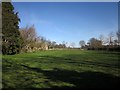
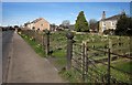
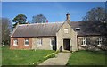
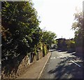
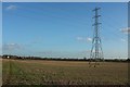
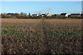
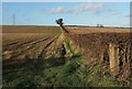
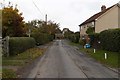
53 photos from this area
Area Information
Key information about the LS22 4ET including its size, population, and administrative classification.
- Area Type
- Postcode
- Area Size
- 72.1 hectares
- Population
- 2016
- Population Density
- 38 people/km²
House Prices in LS22 4ET
48
Properties
£410,559
Average Sold Price
£115,000
Lowest Price
£1,100,000
Highest Price
Showing 48 properties
| Address | Type | Beds | Baths | Last Sale Price | Last Sale Date | |
|---|---|---|---|---|---|---|
| Newstone Chapters, Knaresborough Road, Little Ribston, LS22 4ET | house | - | - | £1,100,000 | Dec 2023 | |
| Greystones, Knaresborough Road, Little Ribston, LS22 4ET | Semi-detached | 3 | 1 | £355,000 | Sep 2022 | |
| Pear Tree Cottage, Knaresborough Road, Little Ribston, LS22 4ET | house | - | - | £332,000 | Jun 2021 | |
| Corner Cottage, Knaresborough Road, Little Ribston, LS22 4ET | house | - | - | £400,000 | May 2021 | |
| Mulberry House, Knaresborough Road, Little Ribston, LS22 4ET | house | 2 | - | £785,000 | May 2017 | |
| The Old Cottage, Knaresborough Road, Little Ribston, LS22 4ET | house | 2 | - | £262,500 | Nov 2016 | |
| Old Toms Cottage, Knaresborough Road, Little Ribston, LS22 4ET | house | - | - | £342,224 | Nov 2016 | |
| Cedar House, Knaresborough Road, Little Ribston, LS22 4ET | house | 6 | - | £660,000 | Oct 2016 | |
| Westwood House, Knaresborough Road, Little Ribston, LS22 4ET | house | 5 | 3 | £605,000 | Apr 2016 | |
| Rowan House, Knaresborough Road, Little Ribston, LS22 4ET | Detached | 6 | - | £565,000 | Feb 2015 |
Page 1 of 5
Energy Efficiency in LS22 4ET
Amenities
Schools
| Rank | School | Type | Entry gender | Ages |
|---|
Explore more schools in this area
Go to Schools tabDemographics
Household Size
Two person
most common
Accommodation Type
Houses
most common
Tenure
74
majority
Ethnic Group
White
most common
Religion
N/A
most common
Household Composition
N/A
most common
Age
47
median
Adults (30-64 years)
most common
Household Deprivation
N/A
with no deprivation
NS-SEC
45
in Lower managerial occupations
Explore more demographic insights in this area
Go to Demographics tabPlanning
Planning Constraints
- Flood RiskPremium
- Ramsar Wetland SitesPremium
- Area of Outstanding Natural BeautyPremium
- Protected Nature ReservePremium
- Protected WoodlandPremium