Area Overview for LS22 4AP
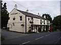
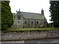
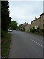
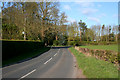
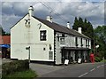
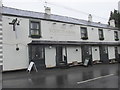
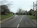
Photos of LS22 4AP
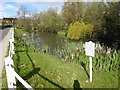
![Low Flush [the village pond], Sicklinghall in LS22 4AP](https://images.propbar.co.uk/images/geograph/66/91/6691934_120.jpg)
55 photos from this area
Area Information
Key information about the LS22 4AP including its size, population, and administrative classification.
- Area Type
- Postcode
- Area Size
- 2.6 hectares
- Population
- 1542
- Population Density
- 55 people/km²
House Prices in LS22 4AP
4
Properties
£966,667
Average Sold Price
£725,000
Lowest Price
£1,300,000
Highest Price
Showing 4 properties
| Address | Type | Beds | Baths | Last Sale Price | Last Sale Date | |
|---|---|---|---|---|---|---|
| Pear Tree Cottage, Main Street, Sicklinghall, LS22 4AP | Detached | 4 | 2 | £725,000 | Sep 2021 | |
| Dairy Farm, Stockeld Lane, Sicklinghall, LS22 4AP | Land | - | - | £1,300,000 | Mar 2021 | |
| Park Grange, Main Street, Sicklinghall, LS22 4AP | Detached | - | - | £875,000 | Sep 2002 | |
| Coxwold, Main Street, Sicklinghall, LS22 4AP | Detached | - | - | - | - |
Energy Efficiency in LS22 4AP
Amenities
Schools
| Rank | School | Type | Entry gender | Ages |
|---|
Explore more schools in this area
Go to Schools tabDemographics
Household Size
Two person
most common
Accommodation Type
Houses
most common
Tenure
75
majority
Ethnic Group
White
most common
Religion
N/A
most common
Household Composition
N/A
most common
Age
47
median
Adults (30-64 years)
most common
Household Deprivation
N/A
with no deprivation
NS-SEC
48
in Lower managerial occupations
Explore more demographic insights in this area
Go to Demographics tabPlanning
Planning Constraints
- Flood RiskPremium
- Ramsar Wetland SitesPremium
- Area of Outstanding Natural BeautyPremium
- Protected Nature ReservePremium
- Protected WoodlandPremium