Area Overview for LS21 2LY
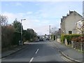
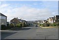
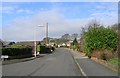
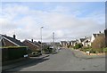
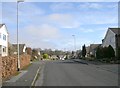
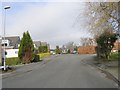
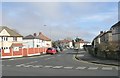
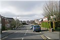
Photos of LS21 2LY


Area Information
LS21 2LY is a compact residential postcode in England, covering 2,673 square metres and home to 1,660 residents. Its high population density of 621,050 people per square kilometre suggests a tightly knit community, though the area remains small enough to feel intimate. The postcode clusters around a mix of housing stock, with 78% of residents owning their homes. This suggests a stable, long-term population, many of whom are likely to be in their 30s to 60s, given the median age of 47. Daily life here is shaped by proximity to essential services, including primary schools, rail links, and retail hubs. While the area lacks natural landmarks or protected sites, its strategic location near Otley and surrounding towns offers access to broader amenities. Living in LS21 2LY means navigating a balance between residential quiet and connectivity, with nearby transport options and shopping facilities within reach. The absence of environmental constraints or flood risks adds to its appeal, though the high density may mean limited open space for residents seeking larger outdoor areas.
- Area Type
- Postcode
- Area Size
- 2673 m²
- Population
- 1660
- Population Density
- 2654 people/km²
The property market in LS21 2LY is characterised by high home ownership, with 78% of residents owning their homes. This indicates a market skewed towards owner-occupation rather than rental, which can influence both property values and availability. The accommodation type is predominantly houses, suggesting a focus on family-friendly or spacious living arrangements. Given the area’s small size and high population density, the housing stock is likely limited, with buyers needing to look beyond LS21 2LY itself to find options in surrounding areas. The absence of flats or apartments implies a lack of high-density housing, which may appeal to those seeking more private, spread-out living but could limit choices for those prioritising urban convenience. For buyers, this means a potentially stable market with fewer speculative properties, though competition for existing homes may be fierce. The emphasis on houses also suggests that the area is less suited to investors seeking rental yields, focusing instead on long-term residency.
House Prices in LS21 2LY
Showing 1 properties
| Address | Type | Beds | Baths | Last Sale Price | Last Sale Date | |
|---|---|---|---|---|---|---|
| Doctors Residence, Wharfedale General Hospital, Newall Carr Road, Otley, LS21 2LY | Retirement | - | - | - | - |
Energy Efficiency in LS21 2LY
Living in LS21 2LY offers access to a range of amenities within practical reach. Retail options include major supermarkets such as Waitrose Otley, Asda Otley, and Spar Otley, ensuring residents have access to daily essentials. The presence of multiple retail outlets suggests a convenience-focused environment, reducing the need for long trips to larger centres. Rail stations like Menston, Burley, and Guiseley provide easy access to nearby towns, while proximity to Leeds Bradford International Airport and Leeds Bradford Airport makes travel beyond the region straightforward. Though the area lacks detailed information on parks or leisure facilities, the availability of retail, transport, and airports indicates a lifestyle that prioritises accessibility and practicality. The compact nature of LS21 2LY means amenities are closely clustered, fostering a sense of community while ensuring residents can meet their needs without extensive travel.
Amenities
Schools
Residents of LS21 2LY have access to two primary schools: Thomas Chippendale Primary School and Weston Lane School. Both institutions serve the local community, providing education for younger children in the area. The presence of two primary schools within proximity offers families options for their children’s early education, though no data on Ofsted ratings or academic performance is available. The absence of secondary schools in the immediate vicinity may require families to consider commuting to nearby towns for secondary education. For those prioritising schools as a key factor, the availability of two primary schools is a positive aspect, but the lack of higher-level educational facilities nearby could be a consideration. The schools’ locations suggest they are integrated into the local infrastructure, likely serving not only LS21 2LY but also surrounding postcode areas.
| Rank | School | Type | Entry gender | Ages |
|---|
Explore more schools in this area
Go to Schools tabDemographics
The community in LS21 2LY is predominantly composed of adults aged 30 to 64, with a median age of 47. This suggests a mature, established population, many of whom are likely to be in their peak earning years or nearing retirement. Home ownership is high, at 78%, indicating a strong preference for long-term residency over rental properties. The area’s accommodation is primarily houses, which aligns with the demographic profile of families or individuals seeking more space. The predominant ethnic group is White, though no specific data on diversity or deprivation levels is provided. The high home ownership rate and stable age range imply a community with a focus on stability and continuity. However, the lack of data on income distribution or deprivation means the area’s economic diversity remains unclear. For those considering LS21 2LY, the demographic profile suggests a neighbourhood that values security and established living, though it may not cater to younger or more transient populations.
Household Size
Accommodation Type
Tenure
Ethnic Group
Religion
Household Composition
Age
Household Deprivation
NS-SEC
Explore more demographic insights in this area
Go to Demographics tabPlanning
Planning Constraints
- Flood RiskPremium
- Ramsar Wetland SitesPremium
- Area of Outstanding Natural BeautyPremium
- Protected Nature ReservePremium
- Protected WoodlandPremium