Area Overview for LS21 1WU
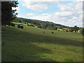
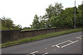
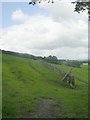
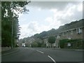
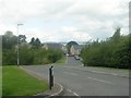
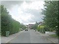
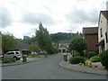
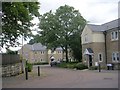
Photos of LS21 1WU


Area Information
LS21 1WU is a small, tightly knit residential postcode in England, home to 2,305 people spread across a compact area with a population density of 594 people per square kilometre. This cluster of homes reflects a community characterised by stability, with a median age of 47 and a majority of residents aged 30–64. The area is predominantly owner-occupied, with 82% of homes owned by their occupants, and most properties are houses rather than flats. Daily life here is shaped by proximity to essential services, including nearby schools, retail hubs, and rail links. The postcode sits in a region where practicality and convenience are prioritised, with residents benefiting from accessible amenities and a low crime rate. While the area is small, its strategic location offers connections to larger towns and cities, making it a viable choice for those seeking a balance between rural tranquillity and urban accessibility. The absence of major environmental constraints, such as protected woodlands or wetlands, means development is not restricted, though the community remains relatively unchanged in character. Living in LS21 1WU offers a straightforward, low-maintenance lifestyle, ideal for those who value security, familiar surroundings, and proximity to key services.
- Area Type
- Postcode
- Area Size
- Not available
- Population
- 2305
- Population Density
- 594 people/km²
The property market in LS21 1WU is dominated by owner-occupied homes, with 82% of properties owned outright by their residents. This high rate of home ownership suggests a stable market with limited rental activity, making it a less common area for short-term tenancies or investment properties. The accommodation type is primarily houses, which is typical for small, rural or semi-rural postcodes where land availability allows for larger homes. Given the area’s small size and the prevalence of houses, the housing stock is likely limited, meaning buyers may need to consider nearby postcodes for additional options. The compact nature of LS21 1WU means property values could be influenced by proximity to amenities such as schools, rail stations, and retail centres. For buyers, this area offers a straightforward purchase process with minimal competition, though the limited housing supply may restrict choices. The focus on owner-occupation also implies that properties are likely to be well-maintained, reflecting the priorities of long-term residents.
House Prices in LS21 1WU
No properties found in this postcode.
Energy Efficiency in LS21 1WU
The lifestyle in LS21 1WU is shaped by its proximity to essential retail and transport hubs. Within reach are notable venues such as Co-op Bramhope, Asda Otley, and Tesco Cookridge, providing a range of shopping and grocery options. These retail outlets cater to daily needs, from household essentials to larger purchases, ensuring residents have access to convenience without needing to travel far. The area’s rail connections, including Weeton, Horsforth, and Guiseley stations, facilitate easy travel to nearby towns and cities, supporting both commuting and leisure activities. While the data does not mention parks or leisure facilities, the presence of multiple rail stations and retail centres suggests a focus on practicality over expansive recreational spaces. The character of LS21 1WU is one of accessibility and simplicity, where daily life revolves around nearby services and efficient transport links. This makes it suitable for those who prioritise convenience over large-scale amenities, though those seeking extensive leisure options may need to look beyond the immediate area.
Amenities
Schools
Residents of LS21 1WU have access to two primary schools within practical reach. The first is Pool-in-Wharfedale Church of England Voluntary Controlled Primary School, which holds an Ofsted rating of ‘good’. This school provides a solid foundation for younger children, with its church-affiliated background potentially offering a distinct educational approach. The second is Pool CofE First and Middle School, which also serves primary education but does not have an Ofsted rating listed in the data. The presence of two primary schools suggests that families have options for early education, though the absence of secondary school data means parents may need to look further afield for secondary education. The availability of local schools is a key factor for families, and the ‘good’ rating at one institution could be a deciding point for those prioritising academic standards. The proximity of these schools to LS21 1WU reinforces the area’s appeal to households with children.
| Rank | School | Type | Entry gender | Ages |
|---|
Explore more schools in this area
Go to Schools tabDemographics
The population of LS21 1WU is predominantly adults, with 30–64-year-olds making up the most common age range. The median age of 47 suggests a mature, established community, likely with long-term residents and families. Home ownership is high, at 82%, indicating a stable housing market where most residents are not renters. The accommodation type is primarily houses, which aligns with the area’s low population density and residential character. The predominant ethnic group is White, though no specific data on diversity or minority representation is provided. The absence of deprivation metrics in the data means the area’s quality of life cannot be assessed in terms of economic hardship, but the high home ownership and age profile suggest a generally affluent or stable demographic. The community appears to prioritise long-term residency over transient living, with no indication of significant student or young professional populations. This demographic profile implies a neighbourhood where social networks are likely to be well-established, and local services cater to the needs of families and middle-aged residents.
Household Size
Accommodation Type
Tenure
Ethnic Group
Religion
Household Composition
Age
Household Deprivation
NS-SEC
Explore more demographic insights in this area
Go to Demographics tabPlanning
Planning Constraints
- Flood RiskPremium
- Ramsar Wetland SitesPremium
- Area of Outstanding Natural BeautyPremium
- Protected Nature ReservePremium
- Protected WoodlandPremium