Area Overview for LS21 1DR
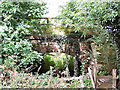
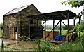
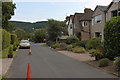
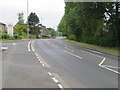
Photos of LS21 1DR


Area Information
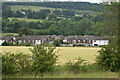
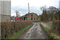
LS21 1DR is a small residential postcode in England, home to 1,731 people spread across a compact area with a population density of 340 people per square kilometre. This is a tightly knit community, typical of smaller postcode clusters where neighbours are likely to know one another. The area’s character is shaped by its demographics: residents are predominantly adults aged 30–64, with a median age of 47. Most homes are owner-occupied, reflecting a stable, long-term presence. While the postcode does not sit within any major natural or protected sites, its proximity to Otley and surrounding towns offers access to broader amenities. Daily life here balances quiet residential living with practical connectivity. The area’s small size means residents are close to local services, schools, and transport links, making it appealing for those seeking a manageable, community-focused environment without the bustle of larger urban centres.
- Area Type
- Postcode
- Area Size
- Not available
- Population
- 1731
- Population Density
- 340 people/km²
In LS21 1DR, 64% of homes are owner-occupied, with the majority being houses rather than flats. This suggests a market skewed towards private ownership, likely attracting buyers seeking long-term stability. The prevalence of houses indicates a focus on family-sized properties, which may appeal to those prioritising space and traditional layouts. As a small postcode area, the housing stock is limited, meaning buyers should consider nearby regions for more options. The high home ownership rate implies lower rental availability, which could be a factor for those needing short-term accommodation. The compact nature of the area means properties are likely to be in close proximity to amenities, though the limited data does not specify property prices or recent trends.
House Prices in LS21 1DR
No properties found in this postcode.
Energy Efficiency in LS21 1DR
Residents of LS21 1DR have access to essential retail outlets such as Asda Otley, Spar Otley, and Sainsburys Otley, ensuring daily shopping needs are met. The area’s rail links to Menston, Guiseley, and Burley connect it to broader regional hubs, facilitating commuting or leisure travel. Nearby airports, including Leeds Bradford International Airport, offer convenient travel options for those needing to fly. While the data does not specify parks or leisure facilities, the presence of retail and transport options suggests a practical, service-oriented lifestyle. The compact nature of the postcode means amenities are within practical reach, supporting a balanced routine of work, shopping, and travel.
Amenities
Schools
The nearest school to LS21 1DR is St Joseph’s Catholic Primary School in Otley, which is rated ‘good’ by Ofsted. This school serves the primary education needs of the area, offering a religiously affiliated curriculum. While the data lists the same school twice, it confirms its significance as the primary educational institution nearby. Families in LS21 1DR rely on this school for their children’s early education, and its ‘good’ rating suggests a satisfactory standard of teaching and facilities. The absence of secondary schools or alternative educational providers in the immediate vicinity means parents may need to consider commuting to nearby towns for higher education.
| Rank | School | Type | Entry gender | Ages |
|---|
Explore more schools in this area
Go to Schools tabDemographics
The population of LS21 1DR is 1,731, with a median age of 47, indicating a mature demographic. The majority of residents are adults aged 30–64, suggesting a community with established careers and families. Home ownership is high at 64%, with most properties being houses rather than flats, reflecting a preference for traditional, family-friendly housing. The predominant ethnic group is White, which aligns with broader regional trends. This age profile and ownership pattern imply a stable, low-turnover community where long-term residency is common. The absence of specific data on deprivation or diversity means the area’s social dynamics are not explicitly detailed, but the demographic composition suggests a cohesive, middle-aged population with strong ties to local institutions.
Household Size
Accommodation Type
Tenure
Ethnic Group
Religion
Household Composition
Age
Household Deprivation
NS-SEC
Explore more demographic insights in this area
Go to Demographics tabPlanning
Planning Constraints
- Flood RiskPremium
- Ramsar Wetland SitesPremium
- Area of Outstanding Natural BeautyPremium
- Protected Nature ReservePremium
- Protected WoodlandPremium