Area Overview for LS2 9NF
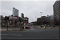
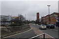
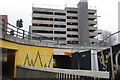
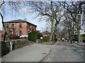
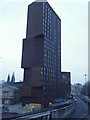
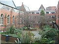
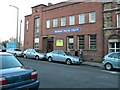
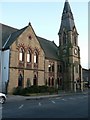
Photos of LS2 9NF


Area Information
LS2 9NF is a small residential cluster in England with a population of 4342, characterised by a tight-knit community feel. The area is home to a predominantly young demographic, with a median age of 22 and the most common age range being 15–29 years. This suggests a dynamic, student- or young professional-oriented environment. The area’s compact size means residents have easy access to nearby amenities, including multiple retail outlets, rail stations, and Leeds Bradford Airport. The presence of both primary and sixth-form schools indicates it caters to families at different life stages. While the housing stock is largely flat-based, with only 9% owner-occupation, the area’s proximity to transport links and services makes it convenient for commuters. Living here involves a balance of urban accessibility and residential simplicity, though the low home ownership rate points to a rental-focused market. The area’s character is shaped by its youthful population and practical infrastructure, offering a straightforward lifestyle for those prioritising connectivity over traditional homeownership.
- Area Type
- Postcode
- Area Size
- Not available
- Population
- 4342
- Population Density
- 9101 people/km²
The property market in LS2 9NF is heavily rental-driven, with just 9% of homes owner-occupied. The accommodation type is exclusively flats, reflecting a housing stock tailored to transient or younger residents. This suggests limited opportunities for long-term homeownership within the area itself, with buyers likely needing to look beyond LS2 9NF for traditional housing options. The flat-based market may appeal to renters seeking affordability or those prioritising proximity to transport links, such as the nearby rail stations and Leeds Bradford Airport. However, the small size of the area means the surrounding neighbourhoods may share similar characteristics. For buyers, this implies a focus on rental properties rather than purchase, though the area’s practicality for commuters could offset the lack of owner-occupied stock.
House Prices in LS2 9NF
No properties found in this postcode.
Energy Efficiency in LS2 9NF
Daily life in LS2 9NF is shaped by its proximity to essential amenities. The area includes five retail outlets, such as Co-op Leeds and Tesco Leeds, providing convenience for shopping and daily needs. Rail stations like Leeds Railway Station and Headingley offer easy access to urban hubs, while Leeds Bradford Airport serves as a gateway for regional and international travel. Though parks or leisure facilities are not explicitly mentioned in the data, the presence of multiple rail stations and retail options suggests a lifestyle focused on practicality and connectivity. The area’s compact size means residents can access these amenities without long commutes, though the lack of specific details on green spaces or recreational facilities may be a consideration for those prioritising outdoor activities.
Amenities
Schools
Residents of LS2 9NF have access to a range of educational institutions, including St Anne’s RC First School, a primary school, and Park Lane College and Luminate Education Group, both sixth-form colleges. Swarthmore Education Centre, a special school, further diversifies the educational landscape. The presence of primary and post-16 education options suggests the area supports families through multiple stages of schooling. While no Ofsted ratings are provided, the variety of school types indicates choices for both mainstream and specialist education. For families, this mix may be advantageous, though the lack of secondary schools in the immediate vicinity could necessitate travel for older students. The availability of sixth-form colleges also aligns with the area’s young demographic, offering pathways to higher education or vocational training.
| Rank | School | Type | Entry gender | Ages |
|---|
Explore more schools in this area
Go to Schools tabDemographics
The population of LS2 9NF is overwhelmingly young, with a median age of 22 and the majority of residents falling within the 15–29 age bracket. This reflects a community skewed towards students, young professionals, or those in early careers. Only 9% of households are owner-occupied, indicating a strong rental market, which aligns with the accommodation type data showing flats as the predominant housing form. The ethnic composition is predominantly White, with no specific data on diversity beyond this. The low home ownership rate and focus on flats suggest a transient population, possibly influenced by the area’s proximity to educational institutions and transport hubs. For quality of life, the absence of significant deprivation data means the community’s economic profile is not explicitly detailed, but the availability of nearby amenities and transport links implies a functional, if modest, standard of living.
Household Size
Accommodation Type
Tenure
Ethnic Group
Religion
Household Composition
Age
Household Deprivation
NS-SEC
Explore more demographic insights in this area
Go to Demographics tabPlanning
Planning Constraints
- Flood RiskPremium
- Ramsar Wetland SitesPremium
- Area of Outstanding Natural BeautyPremium
- Protected Nature ReservePremium
- Protected WoodlandPremium