Area Overview for LS19 7PS
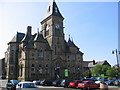
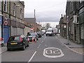
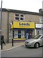
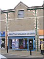
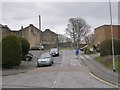
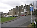
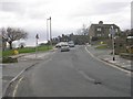
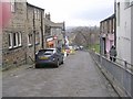
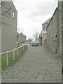
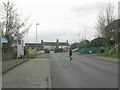
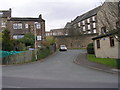
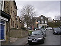
Photos of LS19 7PS
Area Information
LS19 7PS is a compact residential postcode area in England, covering just 3290 square metres and home to 1360 residents. Its high population density—over 413,000 people per square kilometre—reflects a tightly knit community, though the area remains small enough to feel intimate. The postcode includes a cluster of homes, with a median age of 47 and a majority of residents aged 30–64. This suggests a mature, stable population, likely with established careers and families. Living here means proximity to essential services, including multiple retail outlets, railway stations, and two major airports within reach. The area’s size and density make it practical for those prioritising convenience, though its small footprint means limited space for expansion. Residents benefit from strong digital connectivity, with broadband rated excellent and mobile coverage good. However, the area’s safety profile carries a caveat: crime rates are above average, requiring vigilance. For those seeking a quiet, accessible neighbourhood with direct links to transport and retail, LS19 7PS offers a blend of practicality and proximity.
- Area Type
- Postcode
- Area Size
- 3290 m²
- Population
- 1360
- Population Density
- 4536 people/km²
The property market in LS19 7PS is characterised by a low home ownership rate of 36%, indicating that a majority of properties are likely rented. The accommodation type is predominantly houses, which, given the area’s small size, suggests a focus on single-family homes rather than apartments or flats. This mix of rental and owner-occupied properties may appeal to buyers seeking a balance between investment potential and residential comfort. The compact nature of the area means that property availability is limited, and buyers should consider the immediate surroundings for more options. The high population density and small footprint also imply that properties are likely to be closely spaced, with little scope for new developments. For those prioritising a home with a traditional layout and proximity to amenities, LS19 7PS offers a niche market, though competition for available properties may be fierce.
House Prices in LS19 7PS
Showing 1 properties
| Address | Type | Beds | Baths | Last Sale Price | Last Sale Date | |
|---|---|---|---|---|---|---|
| Primary Dental Care Suite, Second Floor, Yeadon Enhanced Primary Care Centre, South View Road, Yeadon, Leeds, LS19 7PS | commercial | - | - | - | - |
Energy Efficiency in LS19 7PS
Living in LS19 7PS provides access to a range of amenities within practical reach. Retail options include Morrisons Yeadon, Aldi Kirk, and Sainsburys Yeadon, offering everyday shopping needs. The area’s proximity to multiple railway stations—Guiseley, Apperley Bridge, and Horsforth—facilitates easy travel to nearby towns and cities. Two major airports, Leeds Bradford Airport and Leeds Bradford International Airport, are also nearby, enhancing connectivity for travel. While the area lacks dedicated parks or leisure facilities, its compact size ensures that essential services are within walking or short driving distance. The presence of multiple retail outlets and transport hubs contributes to a convenient, functional lifestyle, ideal for those prioritising accessibility over expansive green spaces. The community’s density and proximity to amenities create a practical, if small-scale, environment for daily living.
Amenities
Schools
| Rank | School | Type | Entry gender | Ages |
|---|
Explore more schools in this area
Go to Schools tabDemographics
The community in LS19 7PS is predominantly composed of adults aged 30–64, with a median age of 47. This age range suggests a population focused on stability, likely with established careers and family life. Home ownership is relatively low at 36%, indicating a mix of owner-occupied properties and rental homes. The accommodation type is primarily houses, which, combined with the area’s small size, implies a residential character with limited high-density development. The predominant ethnic group is White, reflecting a homogenous demographic profile. With a population density of over 413,000 people per square kilometre, the area is densely populated, which may influence social dynamics and local services. While deprivation data is not explicitly provided, the high population density and moderate home ownership suggest a community where shared resources and communal spaces are likely to be significant.
Household Size
Accommodation Type
Tenure
Ethnic Group
Religion
Household Composition
Age
Household Deprivation
NS-SEC
Explore more demographic insights in this area
Go to Demographics tabPlanning
Planning Constraints
- Flood RiskPremium
- Ramsar Wetland SitesPremium
- Area of Outstanding Natural BeautyPremium
- Protected Nature ReservePremium
- Protected WoodlandPremium