Area Overview for LS19 6NG
Photos of LS19 6NG
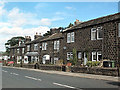
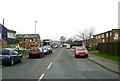
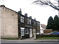
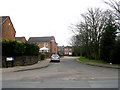
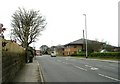
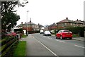
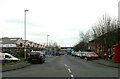
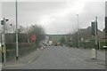
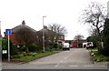
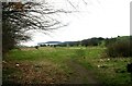
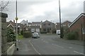
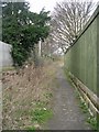
100 photos from this area
Area Information
Key information about the LS19 6NG including its size, population, and administrative classification.
- Area Type
- Postcode
- Area Size
- 1.5 hectares
- Population
- 1340
- Population Density
- 6467 people/km²
House Prices in LS19 6NG
41
Properties
£166,224
Average Sold Price
£38,900
Lowest Price
£365,000
Highest Price
Showing 41 properties
| Address | Type | Beds | Baths | Last Sale Price | Last Sale Date | |
|---|---|---|---|---|---|---|
| 36 Markham Crescent, Rawdon, Leeds, LS19 6NG | Terraced | 3 | 1 | £240,000 | Dec 2024 | |
| 19 Markham Crescent, Rawdon, Leeds, LS19 6NG | Semi-detached | 3 | 1 | £260,000 | Jan 2024 | |
| 46 Markham Crescent, Rawdon, Leeds, LS19 6NG | house | 3 | 1 | £365,000 | Apr 2022 | |
| 28 Markham Crescent, Rawdon, Leeds, LS19 6NG | house | - | - | £310,000 | Nov 2020 | |
| 26 Markham Crescent, Rawdon, Leeds, LS19 6NG | house | 3 | - | £199,950 | Nov 2020 | |
| 17 Markham Crescent, Rawdon, Leeds, LS19 6NG | Semi-detached | 2 | 1 | £185,500 | Nov 2019 | |
| 1 Markham Crescent, Rawdon, Leeds, LS19 6NG | Semi-detached | 3 | 1 | £184,950 | Oct 2018 | |
| 24 Markham Crescent, Rawdon, Leeds, LS19 6NG | Detached | 5 | 3 | £175,000 | May 2017 | |
| 23 Markham Crescent, Rawdon, Leeds, LS19 6NG | Terraced | 3 | - | £210,000 | Apr 2017 | |
| 20 Markham Crescent, Rawdon, Leeds, LS19 6NG | Semi-detached | 3 | - | £199,950 | Nov 2016 |
Page 1 of 5
Energy Efficiency in LS19 6NG
Amenities
Schools
| Rank | School | Type | Entry gender | Ages |
|---|
Explore more schools in this area
Go to Schools tabDemographics
Household Size
Family (3-5 people)
most common
Accommodation Type
Houses
most common
Tenure
78
majority
Ethnic Group
White
most common
Religion
N/A
most common
Household Composition
N/A
most common
Age
47
median
Adults (30-64 years)
most common
Household Deprivation
N/A
with no deprivation
NS-SEC
40
in Lower managerial occupations
Explore more demographic insights in this area
Go to Demographics tabPlanning
Planning Constraints
- Flood RiskPremium
- Ramsar Wetland SitesPremium
- Area of Outstanding Natural BeautyPremium
- Protected Nature ReservePremium
- Protected WoodlandPremium