Area Overview for LS18 5RP
Photos of LS18 5RP
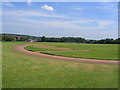
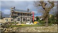
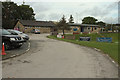


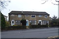

49 photos from this area
Area Information
Key information about the LS18 5RP including its size, population, and administrative classification.
- Area Type
- Postcode
- Area Size
- 1.7 hectares
- Population
- 1371
- Population Density
- 886 people/km²
House Prices in LS18 5RP
18
Properties
£377,107
Average Sold Price
£185,000
Lowest Price
£695,000
Highest Price
Showing 18 properties
| Address | Type | Beds | Baths | Last Sale Price | Last Sale Date | |
|---|---|---|---|---|---|---|
| 24 Southway, Horsforth, Leeds, LS18 5RP | Flat | - | - | £252,000 | Aug 2021 | |
| 14 Southway, Horsforth, Leeds, LS18 5RP | house | - | - | £600,000 | Oct 2020 | |
| 34 Southway, Horsforth, Leeds, LS18 5RP | Detached | 5 | 3 | £695,000 | May 2018 | |
| 32 Southway, Horsforth, Leeds, LS18 5RP | house | 3 | - | £420,000 | Apr 2011 | |
| 12 Southway, Horsforth, Leeds, LS18 5RP | house | - | - | £353,750 | Feb 2011 | |
| 22 Southway, Horsforth, Leeds, LS18 5RP | Flat | - | - | £205,000 | Mar 2010 | |
| 16 Southway, Horsforth, Leeds, LS18 5RP | house | - | - | £580,000 | Jan 2010 | |
| 4 Southway, Horsforth, Leeds, LS18 5RP | Detached | - | - | £310,000 | Apr 2009 | |
| Beechwood, 20 Southway, Horsforth, Leeds, LS18 5RP | Flat | - | - | £227,950 | Jun 2006 | |
| 18 Southway, Horsforth, Leeds, LS18 5RP | Flat | - | - | £185,000 | Dec 2004 |
Page 1 of 2
Energy Efficiency in LS18 5RP
Amenities
Schools
| Rank | School | Type | Entry gender | Ages |
|---|
Explore more schools in this area
Go to Schools tabDemographics
Household Size
Family (3-5 people)
most common
Accommodation Type
Houses
most common
Tenure
95
majority
Ethnic Group
White
most common
Religion
N/A
most common
Household Composition
N/A
most common
Age
47
median
Adults (30-64 years)
most common
Household Deprivation
N/A
with no deprivation
NS-SEC
51
in Lower managerial occupations
Explore more demographic insights in this area
Go to Demographics tabPlanning
Planning Constraints
- Flood RiskPremium
- Ramsar Wetland SitesPremium
- Area of Outstanding Natural BeautyPremium
- Protected Nature ReservePremium
- Protected WoodlandPremium