Area Overview for LS18 4UN
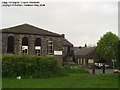
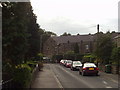
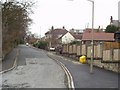
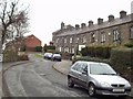
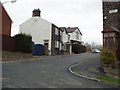
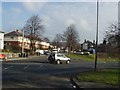
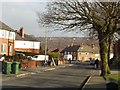
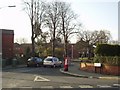
Photos of LS18 4UN


Area Information
LS18 4UN is a small residential postcode in England, home to 1750 people living in a compact cluster of houses. The area’s character is defined by its mature population, with a median age of 47 and most residents falling within the 30-64 age range. This suggests a community of established professionals and families, many of whom own their homes. The area is quiet and unassuming, with no major landmarks or commercial hubs nearby, but it benefits from proximity to Horsforth, a larger town offering amenities. Daily life here is likely to revolve around local shops, rail connections, and nearby schools. The postcode’s small size means it is not densely populated, creating a sense of space and privacy. While it lacks the vibrancy of urban centres, its appeal lies in its simplicity, with straightforward access to transport networks and a low risk of environmental hazards. For buyers seeking a low-maintenance, residential environment with a focus on stability, LS18 4UN offers a practical option.
- Area Type
- Postcode
- Area Size
- Not available
- Population
- 1750
- Population Density
- 4478 people/km²
LS18 4UN is a small area with a housing stock dominated by houses rather than flats, and 55% of properties are owner-occupied. This suggests a community where homeownership is the norm, likely attracting buyers seeking long-term stability. The limited size of the postcode means the property market is not expansive, and buyers may need to consider nearby areas for more options. The focus on houses indicates a preference for family homes or larger properties, which may appeal to those prioritising space over density. However, the small population and lack of commercial development suggest a modest market, with limited scope for investment or rental opportunities. Buyers should approach the area with an understanding of its niche nature, balancing the benefits of a quiet, residential environment against the constraints of a limited housing supply.
House Prices in LS18 4UN
No properties found in this postcode.
Energy Efficiency in LS18 4UN
Residents of LS18 4UN have access to a range of practical amenities within reach, including retail options like Tesco Horsforth, Morrisons Horsforth, and Morrisons Daily. These stores provide essential shopping needs, reducing the need for long trips. The area’s rail stations—Horsforth, Kirkstall Forge, and Bramley—offer convenient links to public transport, facilitating travel to larger towns and cities. Nearby Leeds Bradford International Airport is a significant asset for frequent travelers. While the area lacks large-scale leisure or entertainment facilities, the presence of local shops and rail connections ensures a functional lifestyle. The combination of retail, transport, and proximity to an airport supports a practical, low-maintenance daily routine, though those seeking a more vibrant social scene may need to look beyond the immediate vicinity.
Amenities
Schools
The nearest school to LS18 4UN is Horsforth Featherbank Primary School, which holds an outstanding Ofsted rating. This school is a key asset for families in the area, providing high-quality primary education within reach. The absence of secondary schools in the immediate vicinity means parents may need to consider commuting to nearby towns for secondary education. However, the presence of a top-rated primary school is a strong selling point for those prioritising early education. The school’s performance suggests a focus on academic excellence and student welfare, which can be a deciding factor for families. While the data does not include other schools, the availability of this primary institution indicates that the area is suitable for those with young children, provided they are willing to plan for secondary schooling elsewhere.
| Rank | School | Type | Entry gender | Ages |
|---|
Explore more schools in this area
Go to Schools tabDemographics
The population of LS18 4UN is predominantly adults aged 30-64, with a median age of 47. This indicates a community of middle-aged residents, many of whom are likely to be homeowners, with 55% of properties owned by occupants. The area is characterised by houses rather than flats, reflecting a preference for single-family dwellings. The predominant ethnic group is White, though no specific data on diversity or deprivation is available. The age profile suggests a stable, settled population, with fewer young families or elderly residents compared to other areas. This demographic structure may influence local services and amenities, which appear tailored to the needs of working-age adults and their households. The absence of detailed diversity statistics means the community’s social composition remains largely unexplored in the data.
Household Size
Accommodation Type
Tenure
Ethnic Group
Religion
Household Composition
Age
Household Deprivation
NS-SEC
Explore more demographic insights in this area
Go to Demographics tabPlanning
Planning Constraints
- Flood RiskPremium
- Ramsar Wetland SitesPremium
- Area of Outstanding Natural BeautyPremium
- Protected Nature ReservePremium
- Protected WoodlandPremium