Area Overview for LS18 4TR
Photos of LS18 4TR
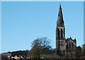
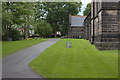
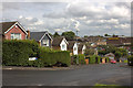

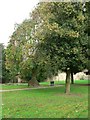
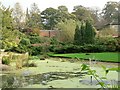

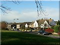
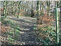
100 photos from this area
Area Information
Key information about the LS18 4TR including its size, population, and administrative classification.
- Area Type
- Postcode
- Area Size
- 2468 m²
- Population
- 1728
- Population Density
- 4650 people/km²
House Prices in LS18 4TR
24
Properties
£170,569
Average Sold Price
£146,000
Lowest Price
£198,000
Highest Price
Showing 24 properties
| Address | Type | Beds | Baths | Last Sale Price | Last Sale Date | |
|---|---|---|---|---|---|---|
| 7, Town Square, Kerry Garth, Horsforth, Leeds, LS18 4TR | Flat | 2 | 2 | £195,000 | Mar 2025 | |
| 9, Town Square, Kerry Garth, Horsforth, Leeds, LS18 4TR | Flat | - | - | £198,000 | Dec 2023 | |
| 12, Town Square, Kerry Garth, Horsforth, Leeds, LS18 4TR | Flat | 2 | 2 | £184,000 | Apr 2022 | |
| 19, Town Square, Kerry Garth, Horsforth, Leeds, LS18 4TR | Flat | - | - | £185,000 | Oct 2021 | |
| 8, Town Square, Kerry Garth, Horsforth, Leeds, LS18 4TR | Flat | - | - | £188,000 | Sep 2020 | |
| 2, Town Square, Kerry Garth, Horsforth, Leeds, LS18 4TR | Flat | - | - | £179,950 | Jul 2019 | |
| 1, Town Square, Kerry Garth, Horsforth, Leeds, LS18 4TR | Flat | 1 | 1 | £172,000 | Sep 2018 | |
| 24, Town Square, Kerry Garth, Horsforth, Leeds, LS18 4TR | Flat | - | - | £170,000 | Feb 2018 | |
| 16, Town Square, Kerry Garth, Horsforth, Leeds, LS18 4TR | Flat | 2 | 2 | £164,000 | Sep 2017 | |
| 14, Town Square, Kerry Garth, Horsforth, Leeds, LS18 4TR | Flat | - | - | £169,950 | Mar 2017 |
Page 1 of 3
Energy Efficiency in LS18 4TR
Amenities
Schools
| Rank | School | Type | Entry gender | Ages |
|---|
Explore more schools in this area
Go to Schools tabDemographics
Household Size
Family (3-5 people)
most common
Accommodation Type
Houses
most common
Tenure
57
majority
Ethnic Group
White
most common
Religion
N/A
most common
Household Composition
N/A
most common
Age
47
median
Adults (30-64 years)
most common
Household Deprivation
N/A
with no deprivation
NS-SEC
37
in Lower managerial occupations
Explore more demographic insights in this area
Go to Demographics tabPlanning
Planning Constraints
- Flood RiskPremium
- Ramsar Wetland SitesPremium
- Area of Outstanding Natural BeautyPremium
- Protected Nature ReservePremium
- Protected WoodlandPremium