Area Overview for LS18 4FG
Photos of LS18 4FG
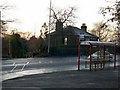
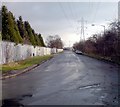
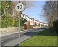
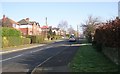
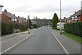
100 photos from this area
Area Information
Key information about the LS18 4FG including its size, population, and administrative classification.
- Area Type
- Postcode
- Area Size
- 3.6 hectares
- Population
- 2677
- Population Density
- 1623 people/km²
House Prices in LS18 4FG
99
Properties
£421,047
Average Sold Price
£293,950
Lowest Price
£802,000
Highest Price
Showing 99 properties
| Address | Type | Beds | Baths | Last Sale Price | Last Sale Date | |
|---|---|---|---|---|---|---|
| 35 Bletchley Road, Horsforth, Leeds, LS18 4FG | Detached | 3 | 2 | £435,000 | Jan 2025 | |
| 57 Bletchley Road, Horsforth, Leeds, LS18 4FG | Detached | 3 | 2 | £426,150 | Dec 2024 | |
| 79 Bletchley Road, Horsforth, Leeds, LS18 4FG | Detached | 4 | 2 | £802,000 | Oct 2023 | |
| 82 Bletchley Road, Horsforth, Leeds, LS18 4FG | Detached | 4 | 2 | £470,000 | Jul 2023 | |
| 59 Bletchley Road, Horsforth, Leeds, LS18 4FG | Detached | 4 | 2 | £492,000 | Dec 2022 | |
| 86 Bletchley Road, Horsforth, Leeds, LS18 4FG | Retail | 3 | - | £420,000 | Jul 2022 | |
| 27 Bletchley Road, Horsforth, Leeds, LS18 4FG | Terraced | 4 | 2 | £365,000 | Jul 2022 | |
| 84 Bletchley Road, Horsforth, Leeds, LS18 4FG | house | - | - | £390,000 | Feb 2022 | |
| 71 Bletchley Road, Horsforth, Leeds, LS18 4FG | Semi-detached | 4 | 3 | £650,000 | Nov 2021 | |
| 106 Bletchley Road, Horsforth, Leeds, LS18 4FG | Detached | 4 | 2 | £502,000 | Sep 2021 |
Page 1 of 10
Energy Efficiency in LS18 4FG
Amenities
Schools
| Rank | School | Type | Entry gender | Ages |
|---|
Explore more schools in this area
Go to Schools tabDemographics
Household Size
Family (3-5 people)
most common
Accommodation Type
Houses
most common
Tenure
90
majority
Ethnic Group
White
most common
Religion
N/A
most common
Household Composition
N/A
most common
Age
47
median
Adults (30-64 years)
most common
Household Deprivation
N/A
with no deprivation
NS-SEC
61
in Lower managerial occupations
Explore more demographic insights in this area
Go to Demographics tabPlanning
Planning Constraints
- Flood RiskPremium
- Ramsar Wetland SitesPremium
- Area of Outstanding Natural BeautyPremium
- Protected Nature ReservePremium
- Protected WoodlandPremium