Area Overview for LS18 4BS
Photos of LS18 4BS
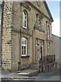
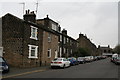
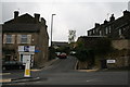


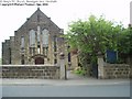
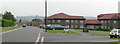
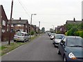
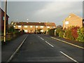
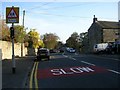
100 photos from this area
Area Information
Key information about the LS18 4BS including its size, population, and administrative classification.
- Area Type
- Postcode
- Area Size
- 1.3 hectares
- Population
- 1692
- Population Density
- 6221 people/km²
House Prices in LS18 4BS
32
Properties
£210,345
Average Sold Price
£53,500
Lowest Price
£359,500
Highest Price
Showing 32 properties
| Address | Type | Beds | Baths | Last Sale Price | Last Sale Date | |
|---|---|---|---|---|---|---|
| 86 Broadgate Lane, Horsforth, Leeds, LS18 4BS | Semi-detached | 3 | 1 | £340,000 | Dec 2024 | |
| 108 Broadgate Lane, Horsforth, Leeds, LS18 4BS | Retail | 3 | 2 | £343,000 | Mar 2023 | |
| 92 Broadgate Lane, Horsforth, Leeds, LS18 4BS | Retail | 3 | 1 | £359,500 | Sep 2022 | |
| 98 Broadgate Lane, Horsforth, Leeds, LS18 4BS | house | - | - | £276,000 | Apr 2021 | |
| 94 Broadgate Lane, Horsforth, Leeds, LS18 4BS | Semi-detached | 3 | 1 | £278,000 | Feb 2019 | |
| 88 Broadgate Lane, Horsforth, Leeds, LS18 4BS | Semi-detached | 3 | - | £250,000 | Sep 2015 | |
| 112 Broadgate Lane, Horsforth, Leeds, LS18 4BS | house | - | - | £265,000 | Apr 2015 | |
| 140 Broadgate Lane, Horsforth, Leeds, LS18 4BS | house | 4 | - | £222,000 | Jan 2014 | |
| 90 Broadgate Lane, Horsforth, Leeds, LS18 4BS | Semi-detached | - | - | £250,000 | Jun 2013 | |
| 120 Broadgate Lane, Horsforth, Leeds, LS18 4BS | house | - | - | £210,000 | Dec 2012 |
Page 1 of 4
Energy Efficiency in LS18 4BS
Amenities
Schools
| Rank | School | Type | Entry gender | Ages |
|---|
Explore more schools in this area
Go to Schools tabDemographics
Household Size
One person
most common
Accommodation Type
Houses
most common
Tenure
47
majority
Ethnic Group
White
most common
Religion
N/A
most common
Household Composition
N/A
most common
Age
47
median
Adults (30-64 years)
most common
Household Deprivation
N/A
with no deprivation
NS-SEC
32
in Lower managerial occupations
Explore more demographic insights in this area
Go to Demographics tabPlanning
Planning Constraints
- Flood RiskPremium
- Ramsar Wetland SitesPremium
- Area of Outstanding Natural BeautyPremium
- Protected Nature ReservePremium
- Protected WoodlandPremium