Area Overview for LS17 9BL
Photos of LS17 9BL
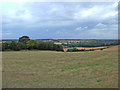


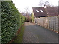


36 photos from this area
Area Information
Key information about the LS17 9BL including its size, population, and administrative classification.
- Area Type
- Postcode
- Area Size
- 1.5 hectares
- Population
- 1549
- Population Density
- 221 people/km²
House Prices in LS17 9BL
17
Properties
£364,886
Average Sold Price
£110,000
Lowest Price
£575,000
Highest Price
Showing 17 properties
| Address | Type | Beds | Baths | Last Sale Price | Last Sale Date | |
|---|---|---|---|---|---|---|
| 11 Albans Close, Bardsey, Leeds, LS17 9BL | Bungalow | 3 | 1 | £535,000 | Sep 2025 | |
| 2 Albans Close, Bardsey, Leeds, LS17 9BL | Detached | 4 | 2 | £575,000 | Sep 2025 | |
| 15 Albans Close, Bardsey, Leeds, LS17 9BL | Detached | 3 | 3 | £457,500 | Nov 2022 | |
| 3 Albans Close, Bardsey, Leeds, LS17 9BL | Bungalow | - | - | £453,000 | Feb 2022 | |
| 19 Albans Close, Bardsey, Leeds, LS17 9BL | Bungalow | 3 | 1 | £366,500 | Jul 2020 | |
| 1 Albans Close, Bardsey, Leeds, LS17 9BL | house | - | - | £340,000 | Apr 2017 | |
| 10 Albans Close, Bardsey, Leeds, LS17 9BL | Bungalow | - | - | £205,000 | Mar 2016 | |
| 4 Albans Close, Bardsey, Leeds, LS17 9BL | Detached | 3 | - | £355,000 | Jul 2015 | |
| 9 Albans Close, Bardsey, Leeds, LS17 9BL | Bungalow | 2 | - | £299,950 | Jul 2012 | |
| 17 Albans Close, Bardsey, Leeds, LS17 9BL | house | 4 | - | £370,000 | Nov 2011 |
Page 1 of 2
Energy Efficiency in LS17 9BL
Amenities
Schools
| Rank | School | Type | Entry gender | Ages |
|---|
Explore more schools in this area
Go to Schools tabDemographics
Household Size
Two person
most common
Accommodation Type
Houses
most common
Tenure
90
majority
Ethnic Group
White
most common
Religion
N/A
most common
Household Composition
N/A
most common
Age
47
median
Adults (30-64 years)
most common
Household Deprivation
N/A
with no deprivation
NS-SEC
54
in Lower managerial occupations
Explore more demographic insights in this area
Go to Demographics tabPlanning
Planning Constraints
- Flood RiskPremium
- Ramsar Wetland SitesPremium
- Area of Outstanding Natural BeautyPremium
- Protected Nature ReservePremium
- Protected WoodlandPremium