Area Overview for LS17 8XR
Photos of LS17 8XR
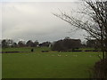
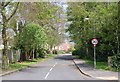
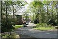
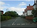
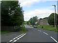
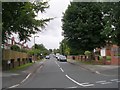
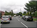
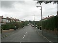
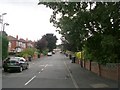
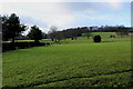
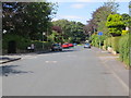
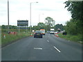
76 photos from this area
Area Information
Key information about the LS17 8XR including its size, population, and administrative classification.
- Area Type
- Postcode
- Area Size
- 2.6 hectares
- Population
- 1337
- Population Density
- 5541 people/km²
House Prices in LS17 8XR
42
Properties
£250,910
Average Sold Price
£70,000
Lowest Price
£450,000
Highest Price
Showing 42 properties
| Address | Type | Beds | Baths | Last Sale Price | Last Sale Date | |
|---|---|---|---|---|---|---|
| 18 Oakdene Way, Alwoodley, Leeds, LS17 8XR | Detached | 3 | 1 | £450,000 | Sep 2025 | |
| 10 Oakdene Way, Alwoodley, Leeds, LS17 8XR | Bungalow | 2 | 1 | £325,000 | May 2024 | |
| 20 Oakdene Way, Alwoodley, Leeds, LS17 8XR | Detached | 3 | 1 | £415,000 | Aug 2023 | |
| 28 Oakdene Way, Alwoodley, Leeds, LS17 8XR | Detached | 4 | 2 | £426,000 | Jun 2021 | |
| 31 Oakdene Way, Alwoodley, Leeds, LS17 8XR | house | - | - | £340,000 | Apr 2021 | |
| 37 Oakdene Way, Alwoodley, Leeds, LS17 8XR | house | - | - | £368,000 | Feb 2021 | |
| 19 Oakdene Way, Alwoodley, Leeds, LS17 8XR | Detached | 3 | 2 | £361,000 | Sep 2019 | |
| 7 Oakdene Way, Alwoodley, Leeds, LS17 8XR | Bungalow | 3 | - | £368,000 | Feb 2018 | |
| 24 Oakdene Way, Alwoodley, Leeds, LS17 8XR | Detached | 3 | 1 | £320,000 | Oct 2017 | |
| 16 Oakdene Way, Alwoodley, Leeds, LS17 8XR | house | - | - | £294,000 | May 2017 |
Page 1 of 5
Energy Efficiency in LS17 8XR
Amenities
Schools
| Rank | School | Type | Entry gender | Ages |
|---|
Explore more schools in this area
Go to Schools tabDemographics
Household Size
Family (3-5 people)
most common
Accommodation Type
Houses
most common
Tenure
77
majority
Ethnic Group
White
most common
Religion
N/A
most common
Household Composition
N/A
most common
Age
47
median
Adults (30-64 years)
most common
Household Deprivation
N/A
with no deprivation
NS-SEC
48
in Lower managerial occupations
Explore more demographic insights in this area
Go to Demographics tabPlanning
Planning Constraints
- Flood RiskPremium
- Ramsar Wetland SitesPremium
- Area of Outstanding Natural BeautyPremium
- Protected Nature ReservePremium
- Protected WoodlandPremium