Area Overview for LS17 8GS
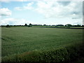
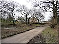
Photos of LS17 8GS


Area Information
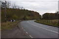
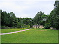
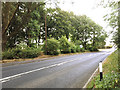
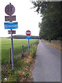
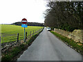
LS17 8GS is a small, tightly knit residential cluster in England, covering just 12.3 hectares. With a population of 1,567 people, it is a compact area where community ties are likely strong, given the high population density of 1,067 people per square kilometre. This postcode is not a sprawling suburb but a focused residential hub, ideal for those seeking a quiet, established neighbourhood. Daily life here is shaped by its proximity to key amenities and transport links, making it accessible to nearby towns and cities. The area’s small size means a sense of familiarity, with residents likely knowing their neighbours. It is a place where convenience meets tranquillity, with minimal environmental constraints and a low crime risk. For buyers, this area offers a blend of practicality and security, with homes primarily in private ownership, suggesting stability and long-term residency. Whether you’re looking for a family home or a retirement property, LS17 8GS provides a balanced mix of residential comfort and connectivity.
- Area Type
- Postcode
- Area Size
- 12.3 hectares
- Population
- 1567
- Population Density
- 1067 people/km²
The property market in LS17 8GS is dominated by owner-occupied homes, with 91% of properties in private hands. This high rate of home ownership suggests a stable, long-term resident base rather than a rental market. The area is composed almost entirely of houses, which are typically larger and more suited to families or multi-generational living. Given the small size of the postcode area, the housing stock is likely limited in volume, meaning properties may be in high demand. Buyers should consider the proximity to amenities and transport links as key factors, as the area’s appeal lies in its convenience and safety. The predominance of houses may also indicate a focus on residential comfort over commercial development, making it an attractive option for those prioritising space and privacy.
House Prices in LS17 8GS
No properties found in this postcode.
Energy Efficiency in LS17 8GS
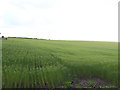
The lifestyle in LS17 8GS is supported by a range of nearby amenities. For shopping, residents have access to Co-op High, Asda Alwoodley, and Sainsburys Wike, providing everyday essentials within reach. The area’s proximity to rail stations and airports enhances mobility, making it easy to travel for work, shopping, or leisure. While the data does not specify parks or leisure facilities, the absence of protected natural areas or planning constraints suggests a focus on residential convenience rather than large-scale green spaces. The compact nature of the postcode means amenities are likely concentrated within a short walk or drive, contributing to a practical, efficient lifestyle.
Amenities
Schools
The nearest school to LS17 8GS is The Grammar School At Leeds, an independent institution. While no Ofsted rating is provided, the presence of an independent school suggests a focus on high-quality education for families. Independent schools often offer smaller class sizes, specialist facilities, and a structured curriculum, which may appeal to parents seeking a particular educational environment. However, the data does not list other schools in the immediate vicinity, so families may need to consider commuting to other local state schools or further afield. The availability of an independent school could be a significant draw for households prioritising educational options, though buyers should verify the school’s current performance and admissions policies.
| Rank | School | Type | Entry gender | Ages |
|---|
Explore more schools in this area
Go to Schools tabDemographics
The community in LS17 8GS is predominantly composed of adults aged 30–64, with a median age of 47. This suggests a mature, settled population, likely with established careers and families. Home ownership is exceptionally high at 91%, indicating a strong preference for private property over rental housing. The area is characterised by houses rather than flats, reflecting a traditional, family-oriented housing stock. The predominant ethnic group is White, which aligns with broader demographic trends in the region. The high home ownership rate and age profile suggest a community with long-term residency and minimal turnover. This stability may contribute to a cohesive neighbourhood culture. However, the data does not indicate specific information on deprivation or income levels, so further analysis would be needed to assess broader quality-of-life factors beyond the provided statistics.
Household Size
Accommodation Type
Tenure
Ethnic Group
Religion
Household Composition
Age
Household Deprivation
NS-SEC
Explore more demographic insights in this area
Go to Demographics tabPlanning
Planning Constraints
- Flood RiskPremium
- Ramsar Wetland SitesPremium
- Area of Outstanding Natural BeautyPremium
- Protected Nature ReservePremium
- Protected WoodlandPremium