Area Overview for LS17 7RJ
Photos of LS17 7RJ
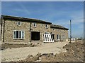
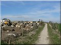
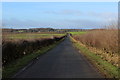
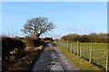
32 photos from this area
Area Information
Key information about the LS17 7RJ including its size, population, and administrative classification.
- Area Type
- Postcode
- Area Size
- 2.0 km²
- Population
- 1445
- Population Density
- 150 people/km²
House Prices in LS17 7RJ
10
Properties
£312,068
Average Sold Price
£249,135
Lowest Price
£375,000
Highest Price
Showing 10 properties
| Address | Type | Beds | Baths | Last Sale Price | Last Sale Date | |
|---|---|---|---|---|---|---|
| 4, Reservoir Cottages, Harrogate Road, Harewood, Leeds, LS17 7RJ | Semi-detached | 3 | 1 | £375,000 | Jun 2024 | |
| 2, Reservoir Cottages, Harrogate Road, Harewood, Leeds, LS17 7RJ | house | - | - | £249,135 | Aug 2009 | |
| The Farm House, Owlet Hall Farm, Eccup Moor Road, Eccup, Leeds, LS17 7RJ | house | 7 | 6 | - | - | |
| The Barn, Owlet Hall Farm, Eccup Moor Road, Eccup, Leeds, LS17 7RJ | house | 6 | - | - | - | |
| The Barn Annexe, Owlet Hall Farm, Eccup Moor Road, Eccup, Leeds, LS17 7RJ | Flat | - | - | - | - | |
| Eccup Filtration Works, Harrogate Road, Harewood, Leeds, LS17 7RJ | office_workshop | - | - | - | - | |
| 1, Reservoir Cottages, Harrogate Road, Harewood, Leeds, LS17 7RJ | house | - | - | - | - | |
| 3, Reservoir Cottages, Harrogate Road, Harewood, Leeds, LS17 7RJ | Semi-detached | - | - | - | - | |
| First Floor Flat, Herd Farm, Harrogate Road, Harewood, Leeds, LS17 7RJ | Flat | - | - | - | - | |
| Farm House Annexe, Owlet Hall Farm, Eccup Moor Road, Eccup, Leeds, LS17 7RJ | Flat | - | - | - | - |
Energy Efficiency in LS17 7RJ
Amenities
Schools
| Rank | School | Type | Entry gender | Ages |
|---|
Explore more schools in this area
Go to Schools tabDemographics
Household Size
Family (3-5 people)
most common
Accommodation Type
Houses
most common
Tenure
86
majority
Ethnic Group
White
most common
Religion
N/A
most common
Household Composition
N/A
most common
Age
47
median
Adults (30-64 years)
most common
Household Deprivation
N/A
with no deprivation
NS-SEC
55
in Lower managerial occupations
Explore more demographic insights in this area
Go to Demographics tabPlanning
Planning Constraints
- Flood RiskPremium
- Ramsar Wetland SitesPremium
- Area of Outstanding Natural BeautyPremium
- Protected Nature ReservePremium
- Protected WoodlandPremium