Area Overview for LS17 7EE
Photos of LS17 7EE

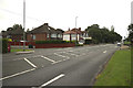
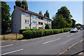
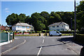
100 photos from this area
Area Information
Key information about the LS17 7EE including its size, population, and administrative classification.
- Area Type
- Postcode
- Area Size
- 1.0 hectares
- Population
- 1383
- Population Density
- 2939 people/km²
House Prices in LS17 7EE
20
Properties
£150,454
Average Sold Price
£80,000
Lowest Price
£225,000
Highest Price
Showing 20 properties
| Address | Type | Beds | Baths | Last Sale Price | Last Sale Date | |
|---|---|---|---|---|---|---|
| 103 Nursery Lane, Moortown, Leeds, LS17 7EE | Semi-detached | 3 | 1 | £220,000 | Jun 2023 | |
| 107 Nursery Lane, Moortown, Leeds, LS17 7EE | Semi-detached | 4 | 2 | £225,000 | Feb 2023 | |
| 101 Nursery Lane, Moortown, Leeds, LS17 7EE | Semi-detached | 3 | 1 | £180,000 | Oct 2017 | |
| 109 Nursery Lane, Moortown, Leeds, LS17 7EE | house | - | - | £137,950 | May 2017 | |
| 83 Nursery Lane, Moortown, Leeds, LS17 7EE | house | 3 | - | £188,000 | Jun 2016 | |
| 81 Nursery Lane, Moortown, Leeds, LS17 7EE | Semi-detached | 3 | 1 | £164,000 | Aug 2008 | |
| 79 Nursery Lane, Moortown, Leeds, LS17 7EE | house | - | - | £80,000 | Oct 2007 | |
| 87 Nursery Lane, Moortown, Leeds, LS17 7EE | Semi-detached | - | - | £147,500 | Nov 2006 | |
| 95 Nursery Lane, Moortown, Leeds, LS17 7EE | Semi-detached | - | - | £132,000 | Jul 2006 | |
| 105 Nursery Lane, Moortown, Leeds, LS17 7EE | house | - | - | £117,500 | Dec 2004 |
Page 1 of 2
Energy Efficiency in LS17 7EE
Amenities
Schools
| Rank | School | Type | Entry gender | Ages |
|---|
Explore more schools in this area
Go to Schools tabDemographics
Household Size
Family (3-5 people)
most common
Accommodation Type
Houses
most common
Tenure
85
majority
Ethnic Group
White
most common
Religion
N/A
most common
Household Composition
N/A
most common
Age
47
median
Adults (30-64 years)
most common
Household Deprivation
N/A
with no deprivation
NS-SEC
49
in Lower managerial occupations
Explore more demographic insights in this area
Go to Demographics tabPlanning
Planning Constraints
- Flood RiskPremium
- Ramsar Wetland SitesPremium
- Area of Outstanding Natural BeautyPremium
- Protected Nature ReservePremium
- Protected WoodlandPremium